
New Zealand Magic: Hiking the Gillespie Track

Alex and I sat in our rental car at the Blue Pools Trailhead and listened to the rain patter against the roof. I let disappointment wash over me. The forecast for the day called for unabating rain but as we drove to the trailhead I still held onto some hope that the forecast would be wrong and the dark, foreboding clouds above us would miraculously dissipate. They did not.
A small part of me wanted to throw in the towel, head back to Wanaka, rent a hotel, and spend the day indoors where we could stay comfortable and dry, and not have to worry about things like trench foot. Ultimately, Alex and I came to the conclusion that we were already at the trailhead, so we might as well go forward with the hike and face whatever weather it would bring. The forecast for the next three days seemed to be favorable but, as I had seen in my first few days on the South Island, the forecast in New Zealand could change on a dime.
The Gillespie Track is traditionally started about a mile outside of the small town of Makarora. It begins by crossing the Makarora River and then heading up into Young Valley. This is a feasible option when it hasn’t been raining for days on end, but the recent torrents in Mt. Aspiring National Park had transformed the Makarora River from docile to raging. Attempting to cross it would have been a death sentence, so we opted to take the Blue Pools route, which added a few miles but saved us from the harrowing crossing.
We started the hike from the Blue Pools trailhead at about 10am, once we had finally gathered enough self-discipline to leave the shelter of the car and head into the rain. Despite the dismal weather and the fact that the Blue Pools would be far from the turquoise shade they are so famous for, we shared the trail with quite a few other tourists. However, once we crossed the Blue Pool bridge we finally found the solitude I have grown so accustomed to on long hikes.

Past the Blue Pools Bridge the trail paralleled the Makarora as it made its way toward Young Valley. We passed through fields and had the road in our peripheral for a few miles. This was demoralizing. Usually as the miles add up on our watches, all signs of modern civilization fade into the distance, but as we plodded along we could still see—and hear—the street traffic just across the river from us. It felt like we weren’t making any progress at all.
We weren’t on the trail for long before we ran into another hiker, an Australian named Aidan (Aidan also happens to be a super talented artist, check out his work HERE!). We had the typical trail exchange: “Where are you going? How many days are you going to be on the trail?” We quickly realized we had planned the exact same hike. So we combined into a group and continued the hike together. Meeting Aidan was a huge boost to our morale. As we got to know our new hiking partner we were distracted from the abysmal conditions in which we were hiking. Aidan had just hiked the Kepler Track and he regaled us with stories from that hike and his other travels.
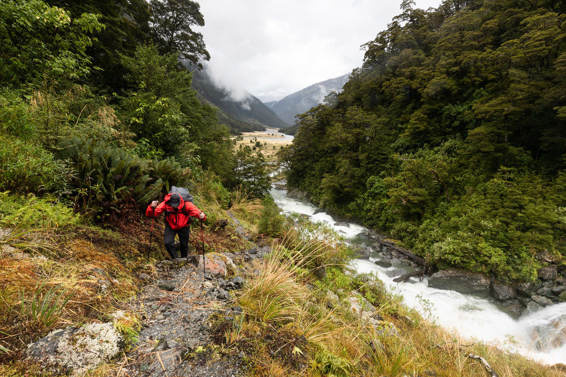
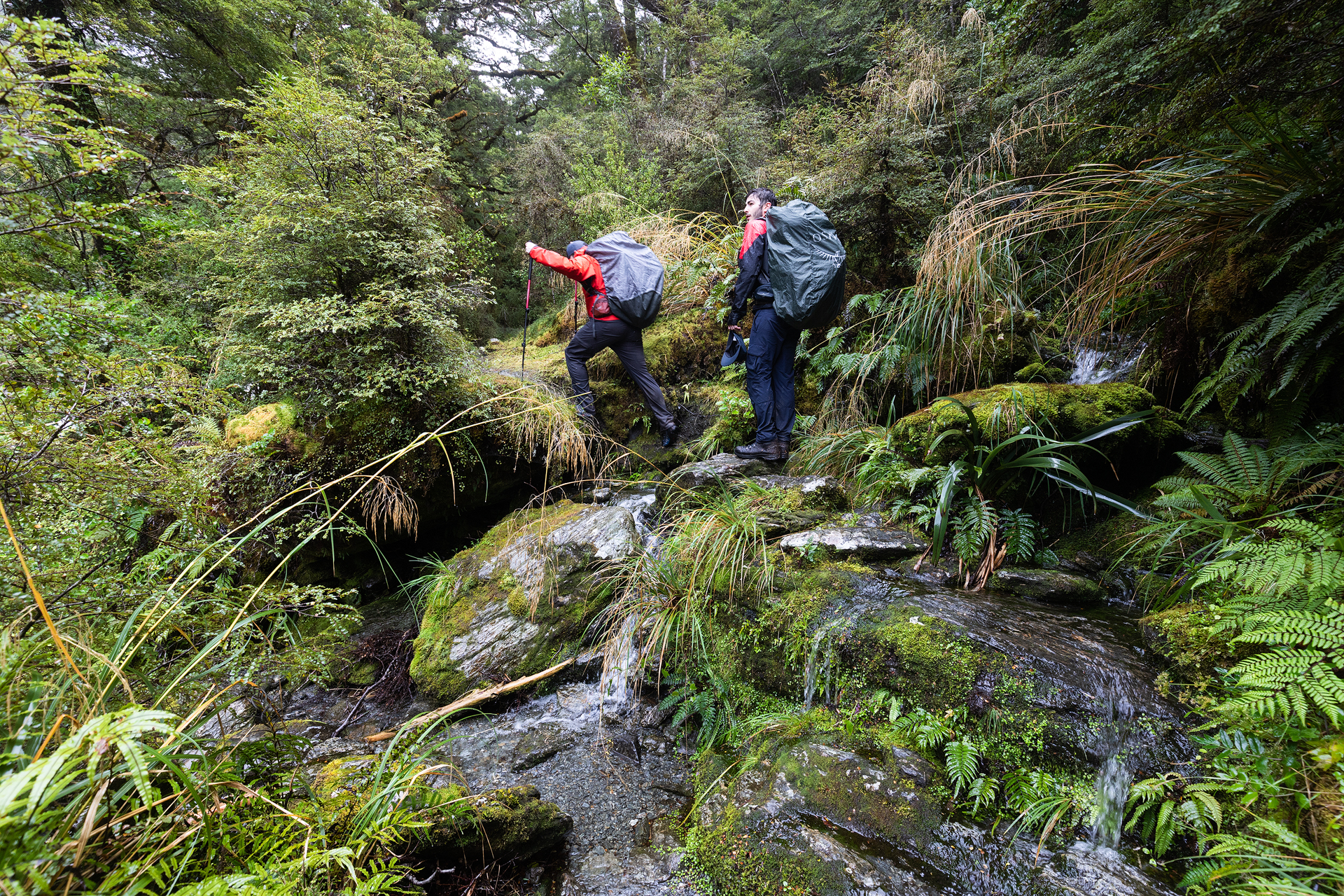

The rain accompanied us all day and we were subjected to stream crossing after stream crossing. At first we made attempts to keep our feet dry by hopping from rock to rock to get over the streams submerging long sections of the trail. It wasn’t long until we realized how futile that was and opted to just ford through the streams, stepping without abandon into ankle deep rivulets.
We had about 17 miles to hike until we made it to our final destination for the first day: Young Hut. At first we remained in semi-upbeat spirits but as we narrowed in on the final couple of miles my spirit began to waver. It was as if my body knew it was so close to rest, warmth, and being dry and every step we couldn’t see the hut was another blow to my depleting morale.

Finally, finally, after about eight hours of hiking I saw a structure in the forest. We had made it! We all but ran up the steps of the hut. We threw down our packs and immediately took off our shoes and socks. The hut was already occupied by a few other hikers, or trampers as they are called in New Zealand. Alex and I picked the top bunks in the first room of the hut and we began stringing out all of our wet clothes on a clothing line someone had hung up in the kitchen area. Someone else started a fire in the wood-burning stove and we all lined up our shoes and socks outside of it, hoping they would be able to dry off even the slightest bit.
I was so emotionally and physically drained from the hike that after dinner I hopped into my bunk and drifted off to sleep.
The next morning I woke up tired. I hadn’t slept well in the bunk and I was sore. I groggily descended from my bunk and headed into the kitchen. I stopped by the stove and grabbed my shoes, they were still wet, as were my socks. I felt my hope deflating again, but then I looked out the window. It was clear. Blue skies and sunshine greeted me. I couldn’t believe—almost didn’t dare to believe it—but there it was: perfect hiking weather.

The second day was going to be another tough one. We had to hike up and over Gillespie Pass, descend to the Siberia Flats, and hike to Siberia Hut where we would spend the next two nights. The sign posted outside Young Hut informed us our hike would take between six and eight hours so we got a relatively early start and hit the trail at 9:30am.
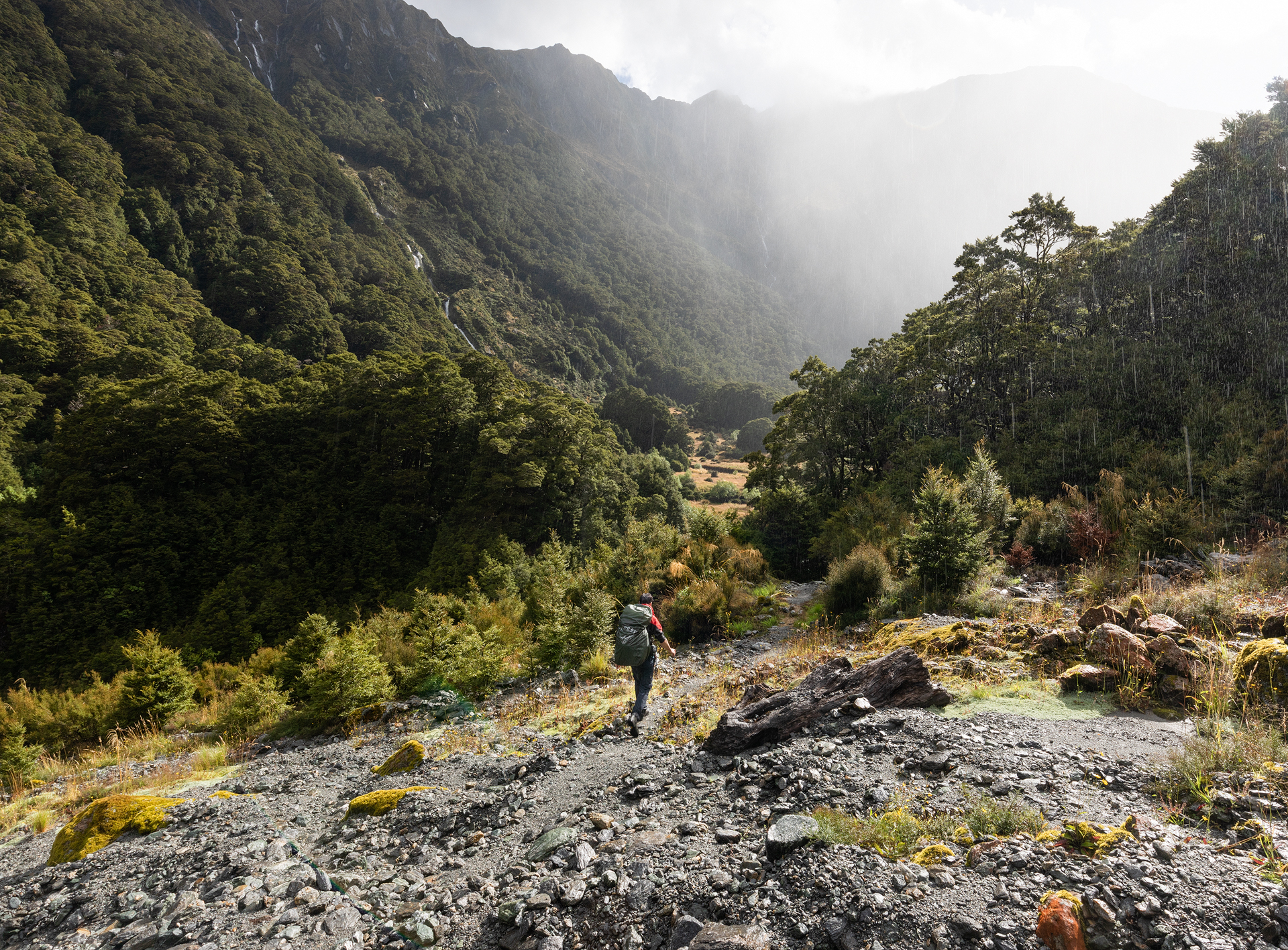
The first portion of the trail took us up a steep path through the forest. While the skies had cleared the water had not quite run off yet so it wasn’t long until our damp feet were soaked once again. After about 20 minutes of hiking we broke out of the forest and could finally see the head of Young Valley. At the head of the valley was a towering basin, with rock faces thousands of feet tall encircling the valley flats far below. I knew we were heading toward Gillespie Pass, but from our vantage point there didn’t seem any viable passes over those imposing rock walls.

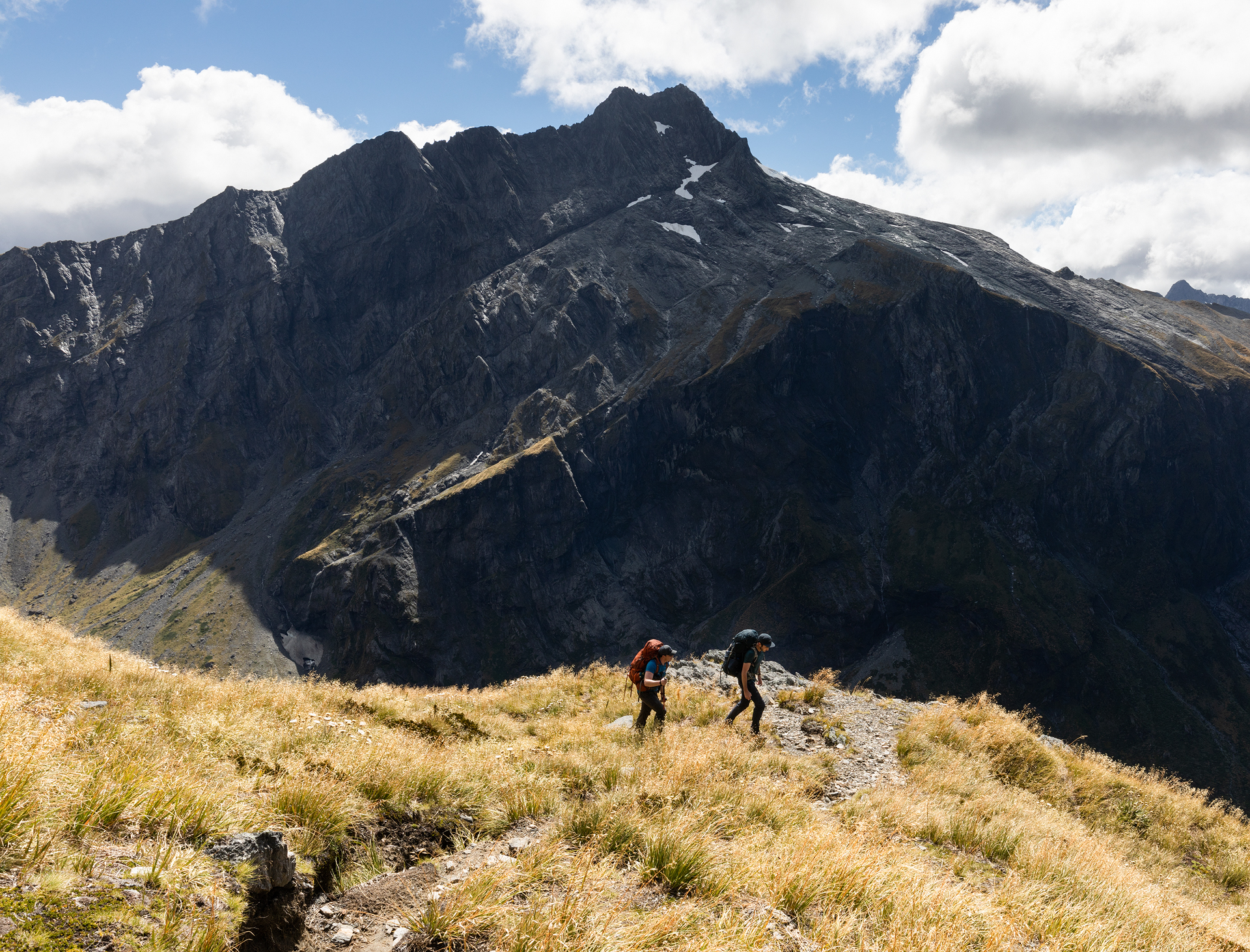
Soon we reached the end of the easy, meandering valley walk and were faced with the arduous task of getting over Gillespie Pass. New Zealand does not employ the use of switchbacks on most of its trails. The trails head impossibly up at 1,000-2,000’ per mile for multiple miles. Nor are the trails maintained to make hikes more bearable. Instead the trails are more or less trampled down sections of forests and hills until, one person after another, a trail was born. Hikers have to use rocks, roots, and foliage to pull themselves up. It’s not so much hiking upward as it is a weird dance of climbing and crawling upward. On these stretches of trails I focused on simply finding a sturdy place to set my foot, hoisted myself up, and then repeated the process with the other foot, for miles. It seemed excruciatingly slow, but then I would look down and see the valley floor far below.

Heading up the steep trail toward Gillespie Pass
It took us an hour and a half of strenuous hiking until we finally found ourselves on Gillespie Pass. The views surrounding us were astounding. We had beautiful views of Mt. Awful and Mt. Dreadful (someone had a bad time in this area back in the day) and the clouds scattered across the sky threw us in and out of shadows, but it never rained. We felt immeasurably grateful to have nice weather on the day we crested Gillespie Pass.
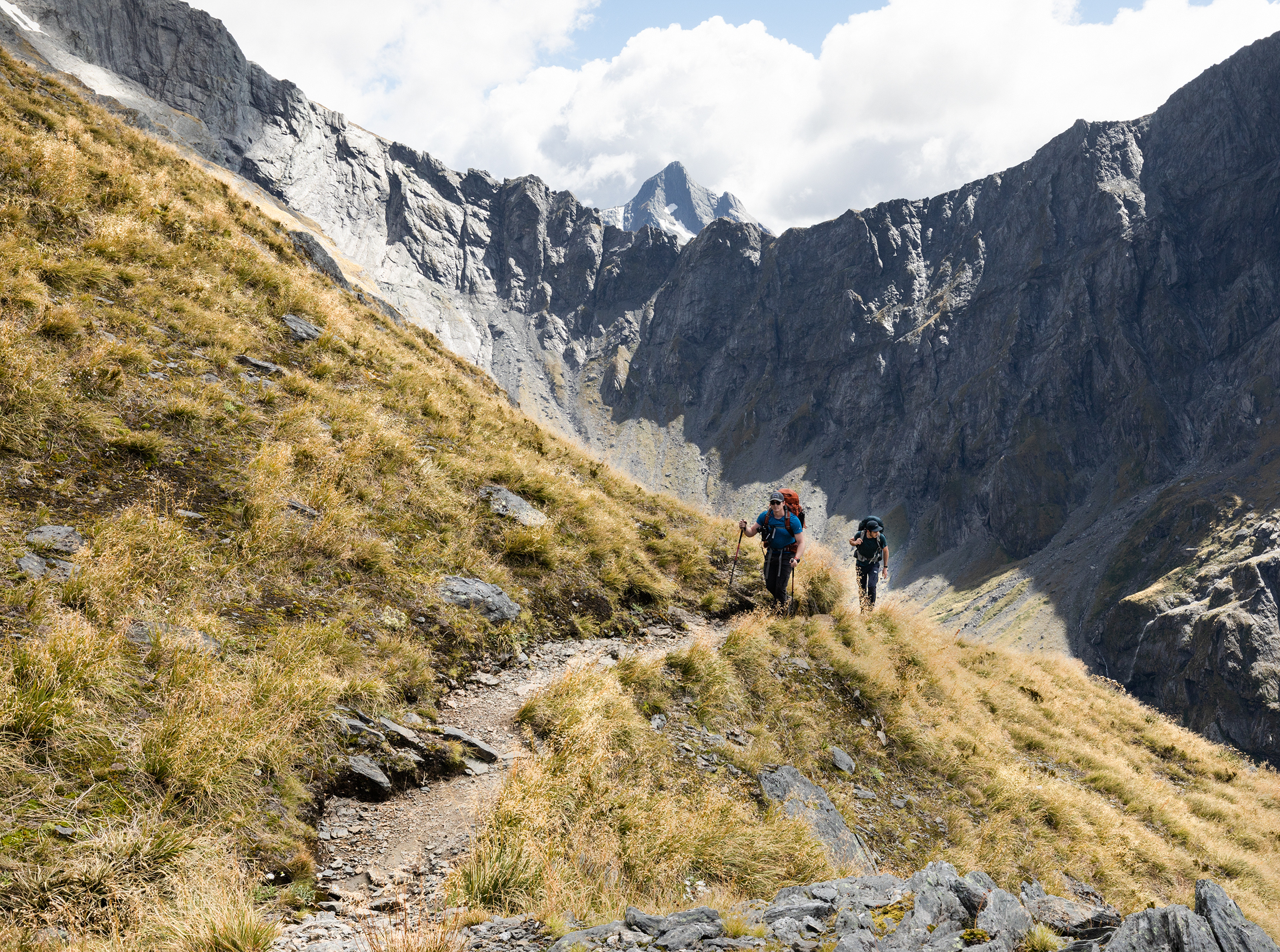

After a brief break for lunch (and a couple of timelapses for Alex) we began to head down the opposite side of the pass. We could see the Siberia Flats far in the distance—they promised to make for an easy hike to our hut—but between the flats and us were miles of steep descent and gnarly forested trails where roots and rocks grabbed at our feet nearly ever step of the way.
The hike was tough, but thankfully the clear skies kept our morale up as we made progress toward the hut. When we finally made it to the flat, soft valley floor we rejoiced. From there it was a leisurely 45 minute stroll until we were on the front porch of the hut. Once again we immediately took off our wet shoes and socks and laid them out to dry. The hut warden, Gerry, came out to greet us and informed us only four people had booked the hut for the night. We would have our pick of the bunks!

Siberia Stream
On the third day of the hike we had planned a day hike to Lake Crucible, a glacial lake located at the head of Crucible Valley, nestled below Mt. Alba. We were grateful for a second day of favorable weather in a row and started out from the hut at 10am, anticipating a 3 hour hike to the lake.
The first hour or so of the trail took us back up the valley we had descended the previous day, but instead of heading up the east side of the valley we headed up the west side. We had a couple of stream crossings on the way, but thankfully the water levels had lowered and we could get across them without any worry.

Crossing Siberia Stream
After the stream crossings, we headed into the forest where we spent about half an hour climbing up roots and rocks until we broke out of the forest and into Crucible Valley. From there we cruised up to the moraine pile at the head of the valley. After a little scrambling we took the final few steps to the ridge of the moraine and saw the most brilliantly blue water come into view. I had seen a few photos of Lake Crucible before our trip so I thought I knew what to expect, but seeing the lake in person was unlike anything I could have ever imagined. The lake sits below Mt. Alba in a basin with walls so tall that they couldn’t fit into my camera’s frame, even when it was wide open. I had to take a 30 image panorama to fully fit the lake and the surrounding peaks.


A 30 image pano of Lake Crucible
When we first arrived to the lake the skies were clear and the sunlight transformed the lake into the most vibrant shade of blue. However, as we lingered clouds started to develop and soon they completely obscured the summits of the mountains surrounding the lake. It seemed as if the best views had passed and the clouds were beginning to look more and more ominous by the moment. We packed up our bags and headed back to Siberia Hut. While we may have basically had the hut to ourselves the prior night, on the second night the hut was booked nearly to capacity.
We spent the evening getting to know our new hut-mates—we played Banagrams, talked about the US’s crazy lack of vacation policy compared to everyone else’s home countries, and when everyone had had enough talking, we read.

This waterfall makes the perfect swimming hole and is only a two minute walk from the front steps of Siberia Hut
On the fourth and final day of the Gillespie Track we awoke to low fog and moody clouds. It had rained during the night but by the time the sun rose it had abated.
We had a relatively easy day ahead of us. We planned to hike about two hours to the designated jet-boat pickup spot. When we first planned this trip we figured we would hike the entire way out, but when we picked up our backcountry hut tickets at the Department of Conservation, the DoC worker told us that instead of attempting the river crossing we could hire a jet-boat to pick us up and whisk us back to town. We quickly jumped at the opportunity. It would be our first time in a jet-boat and it would save us again from the river crossing. It seemed like a win-win.

Our jet-boat was scheduled to pick us up at 1:30pm, but we arrived at around noon. Aidan was scheduled to be on our same boat so he joined us and we sat together and waited. And waited. At around 2pm there was still no boat in sight.
We watched as a helicopter dropped off a few trampers across the river, at Kerin Forks Hut, and flew away. Then, the helicopter came buzzing around the valley, it circled overhead and then came in for a landing in a field right next to us. We joked that the helicopter had come to pick us up. The helicopter touched down and a pilot hopped out, “Want a ride?” He asked us with a smile. He worked for Wilkins River Boats (the company we arranged our jet-boat rides through) and told us that our boat had been cancelled. He said we could go with him or wait for the 2:30pm boat. We answered with a unanimous and emphatic “Yes!” to the helicopter ride. We hurried to gather our gear and headed toward the chopper. Who would turn down a surprise helicopter ride?!

Alex, Aidan, and me in front of our surprise helicopter!
We threw our gear in the storage compartment and quickly climbed to our seats. The pilot got in and, just like that, we were on our way. The ride back to town was a mere five minutes. We saw a couple of people trying to cross the Makarora. “They’re not going to find a crossing today”, the pilot said through the headset. We felt validated in our decision to spend $115/person for the jet-boat ride turned helicopter ride back to town.
It was a little strange being so suddenly dropped back into civilization. One moment we were in the depths of the backcountry and the next we were hiking along a bustling road, making our way back to our car. One thing’s for certain, though: I am so glad we didn’t bail on this trip just because one of the four days was forecast to be dismal. This ended up being my favorite experience of our trip to New Zealand and one of my favorite hikes I’ve ever been on!
