
Cascades Crown Jewel: Skiing Glacier Peak/Dakobed

DATE HIKED:5/27-5/29/23
TOTAL MILEAGE: 34 MILES
TOTAL ELEVATION GAIN: 10,300’
At 10,545’, Glacier Peak/Dakobed is the fifth tallest peak in Washington. It’s also the most remote of the state’s five major volcanos. While all of the other volcanos can be seen from major highways and cities, Glacier Peak is the recluse of the group, cradled deep within the Central Cascades. Summiting the volcano requires a 34 mile round-trip hike with 10,000+’ of gain and is usually done in two to three days. This is a volcano Alex and I have been wanting to ski since we first started ski mountaineering a couple years ago, but its remoteness and reputation as a rugged peak kept us away until this year. The Memorial Day weekend forecast was looking favorable and we felt ready to take on a tough trip. We invited our friend Sander to join us and kept an eye on the forecast as the long weekend approached. I was pleasantly surprised to see suns shining back at me for the foreseeable future. The trip was a go!

Day 1: North Fork Sauk Trailhead to White chuck glacier camp
13 miles, 5,200’ gain
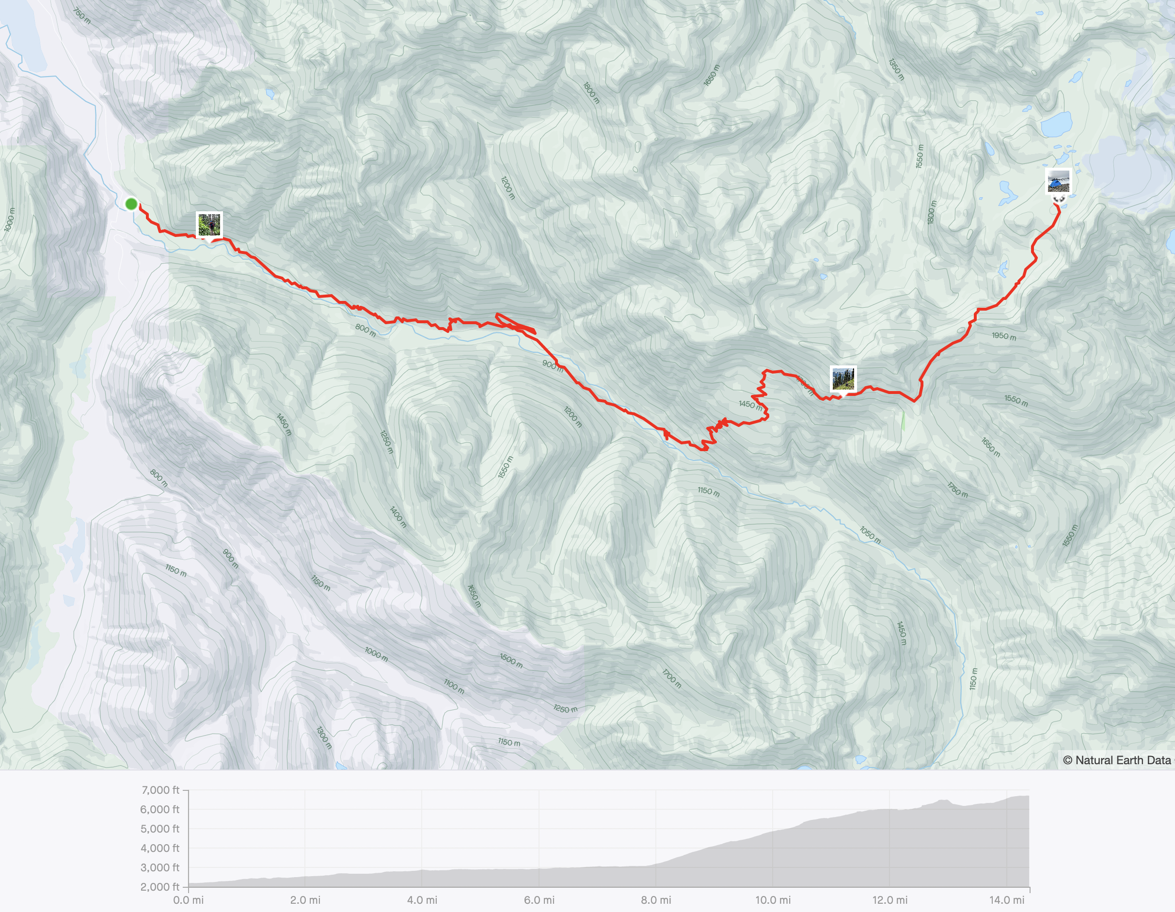
We knew all three days on the trail would be whoppers with each one testing us in a different way. The first day was going to test our strength and endurance while carrying heavy packs. The snow line had crept up to about 6,000’, but the trailhead started at 2,100’, meaning we had nearly 4,000’ to climb before we could take our skis and boots off our packs. Stuffed to the brim with our overnight gear, winter gear, and glacier gear our packs were tipping the scales. Mine came in at 56lbs and Alex’s and Sander’s packs both started at 60lbs. I almost wished I hadn’t known just how heavy my pack was, it was certainly going to be one of the heaviest packs I’d ever carried.
Hoisting the pack onto my back, skis and boots jutting out at an awkward angle, was a comical struggle and as I buckled the clasps and cinched the straps I couldn’t help but feel tinges of doubt. The mountain we aimed to summit still stood miles away. How could I possibly get myself and all my gear to where we needed it to be? But the time for wondering and doubting was short-lived as we all fell into a single file line and headed into the forest.
We started the hike just after 6AM.

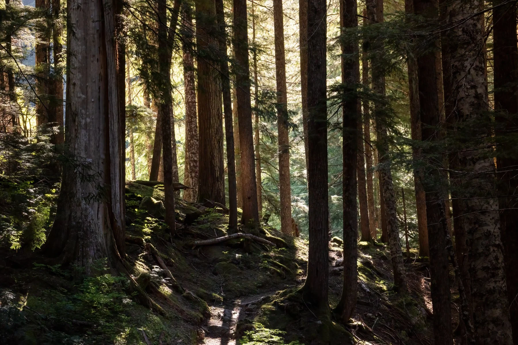
The first five miles of trail were relatively benign, which benefitted us by slowly easing us into the day. The trail meandered through a beautiful old growth forest. We were surrounded by massive, ancient trees in every direction. Western Red Cedars, some 800 years old, stood like solemn guards along the trail. Early morning light filtered through the canopy bathing the entire forest in a warm glow. I was easily distracted along this section and stopped often to snap photos. We reached the Mackinaw Shelter after a couple hours of hiking and took our first long packs-off break. As we sat and enjoyed our snacks a group of six skiers passed us—the first of many groups we saw over the weekend; it turns out we weren’t the only ones enticed by the beautiful weather window that fell over a long weekend.

After the Mackinaw Shelter we began the stretch of trail that I most dreaded. In just over three miles the trail climbed 3,000’ over a series of switchbacks. Sander had scoped this section of the trail out prior to leaving and had counted exactly 26 switchbacks on the route. So every time we rounded a corner I would loudly proclaim, “One!” while Sander counted us down, “Twenty five!”
Incrementally, my numbers grew while Sander’s shrank. We all cheered in unison when we got to “Thirteen! Thirteen” We were halfway up the switchbacks. This counting was a morale boost and distraction. Instead of worrying about the seemingly insurmountable hill we still had to climb, I was focused simply on making it to the next number.
By the time I got to 23 we had reached continuous snow. We kept our trail runners on but left the switchbacks behind and booted straight up through the snow until we merged with the trail again at 5,400’.

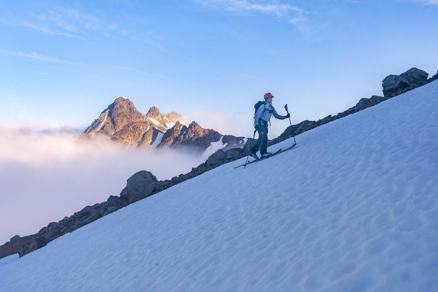
The next leg of the trail would take us to White Pass, where we hoped we would be able to start skiing. We could see the trail undulating toward White Pass in front of us. It resembled a zebra, extended dry sections interspersed with wide, steep snowfields with dangerously long run-outs. While everyone else seemed to adeptly float across these snow patches in their trail runners, I switched to my ski boots for a little more purchase and security.

We reached White Pass after nearly eight hours on the trail, another leg of the day complete. A few groups had convened here and were switching to skinning. We could see the next section of the route—around Marmot Knob—was snow covered and switched to skinning as well.
Even though my skis are ultralight at 5.5lbs, getting them off of my back and onto my feet was a huge relief. My pack felt noticeably lighter as we started toward Marmot Knob. It seemed that everyone’s spirits were buoyed by the change in our travel mode and the lightening of the load.
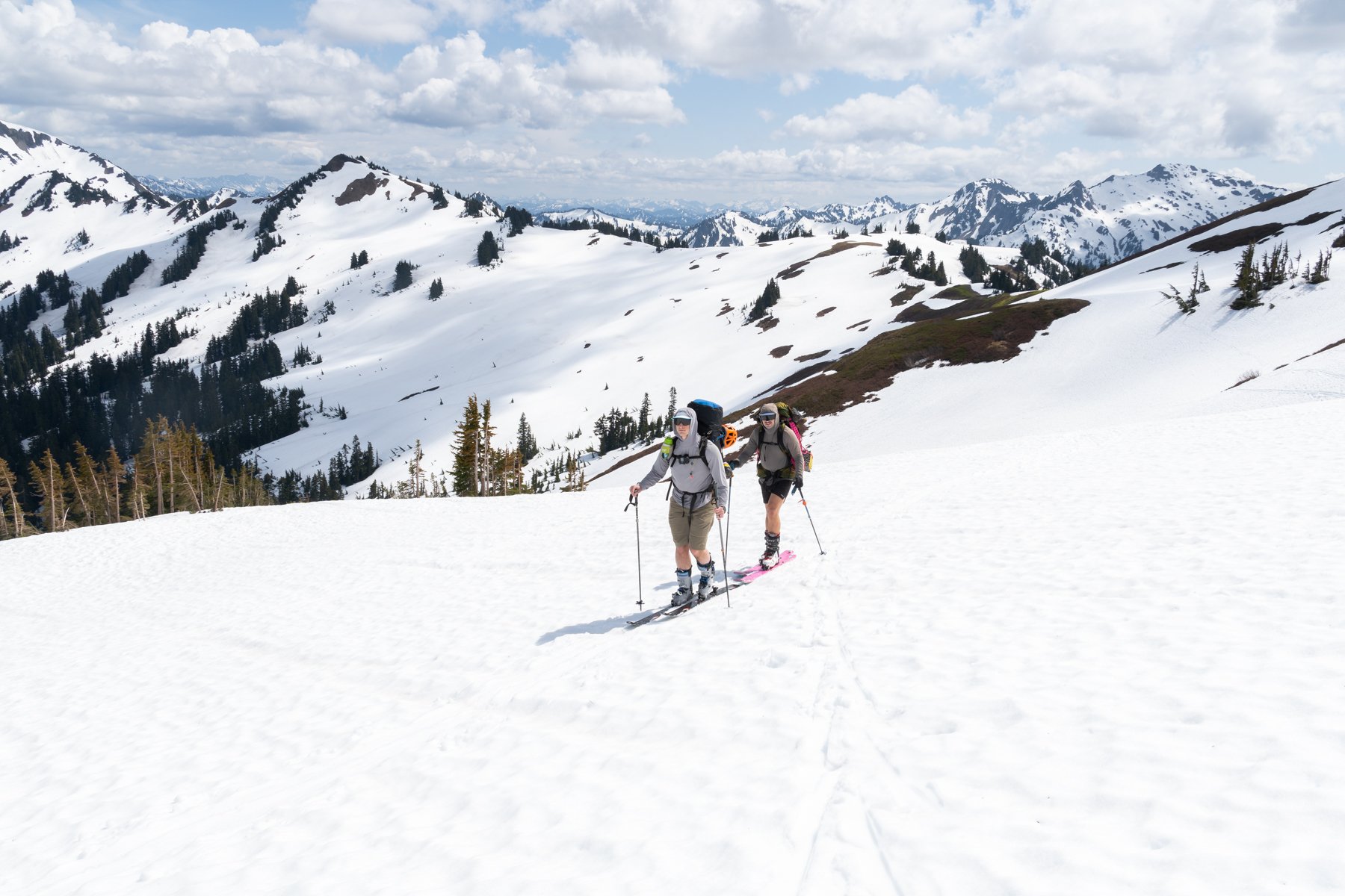
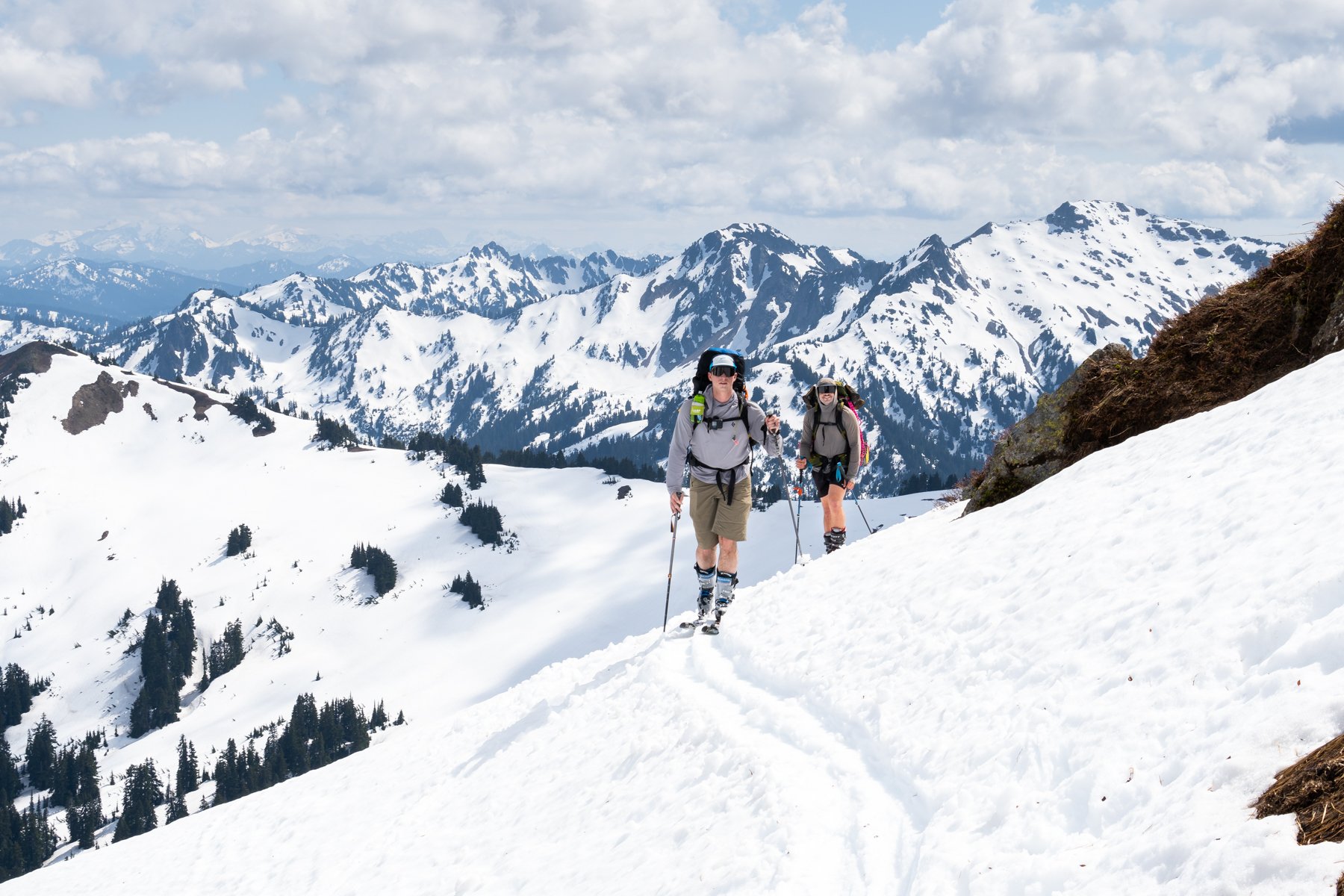

There was enough snow cover that instead of going around Marmot Knob on the summer trail we bumped up to a nice pass at 6,500’ feet between White Mountain and Marmot Knob. From there we enjoyed our first ski of the trip. It was short, but those few turns were a quick reminder of why we were hauling our skis so far into the backcountry in the first place—the skiing was genuinely fun!
We were able to carry enough speed from the pass to reach the base of Marmot Knob where we transitioned back to skinning and began the final push to camp at the base of White Chuck Glacier.


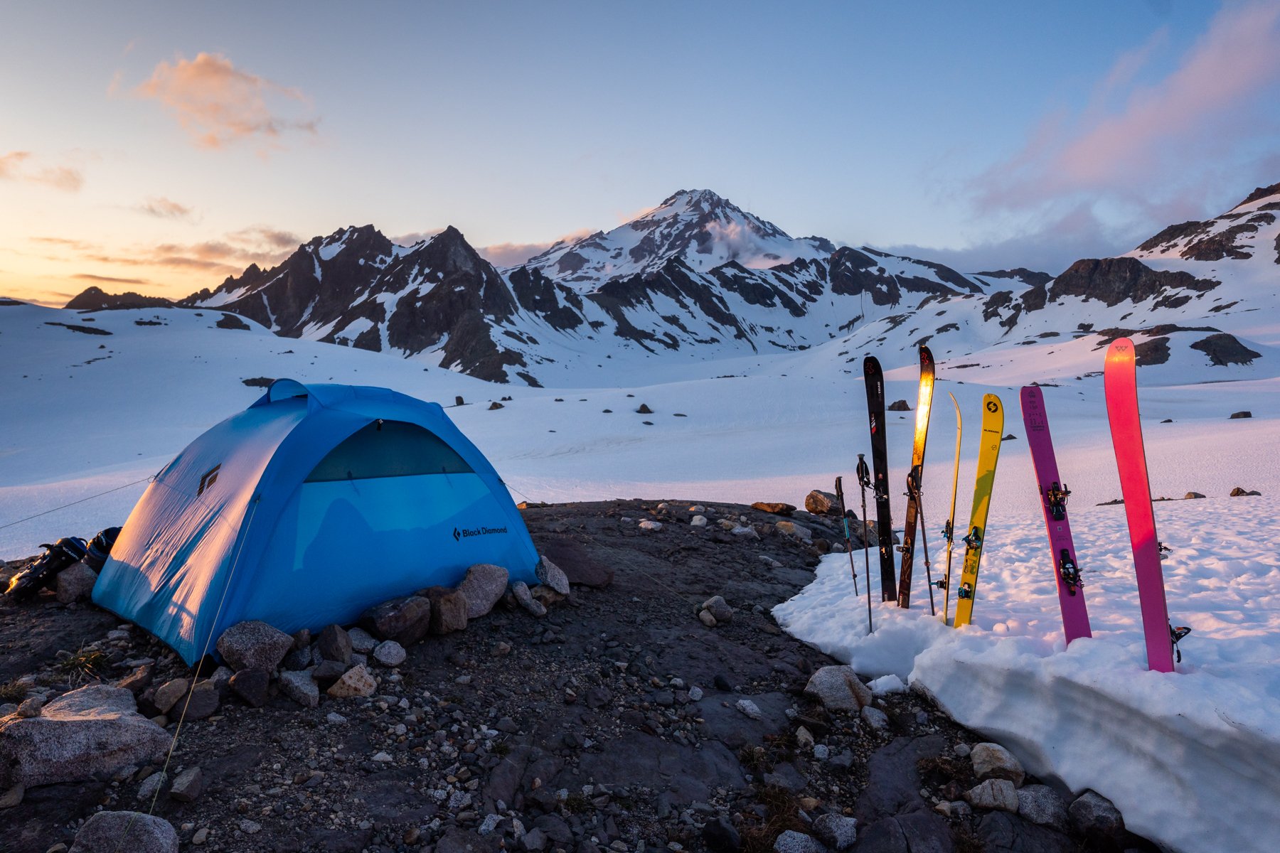
After 10.5 hours we finally made it to camp. We found a melted out expanse of rocks with established campsites and windbreaks and immediately began setting up our tents and melting water.
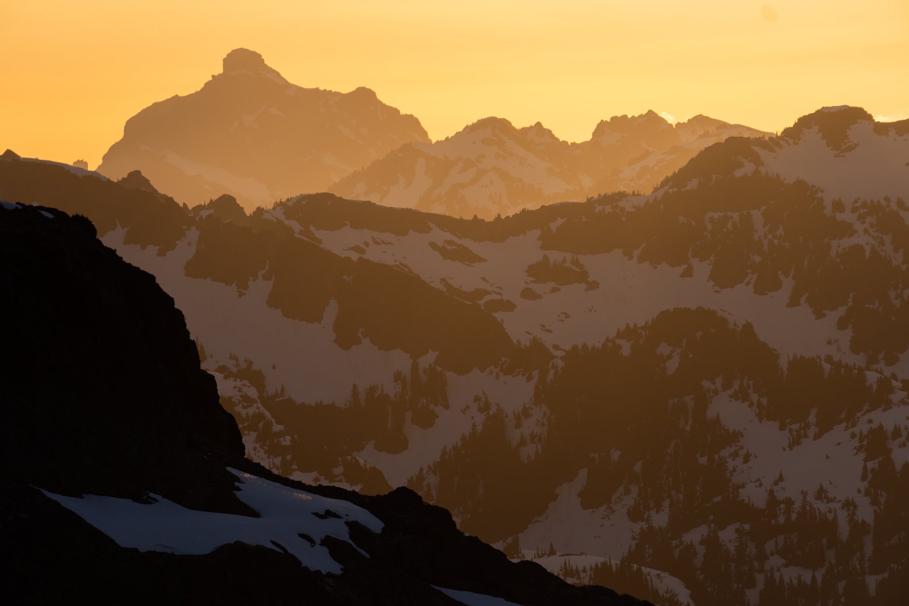
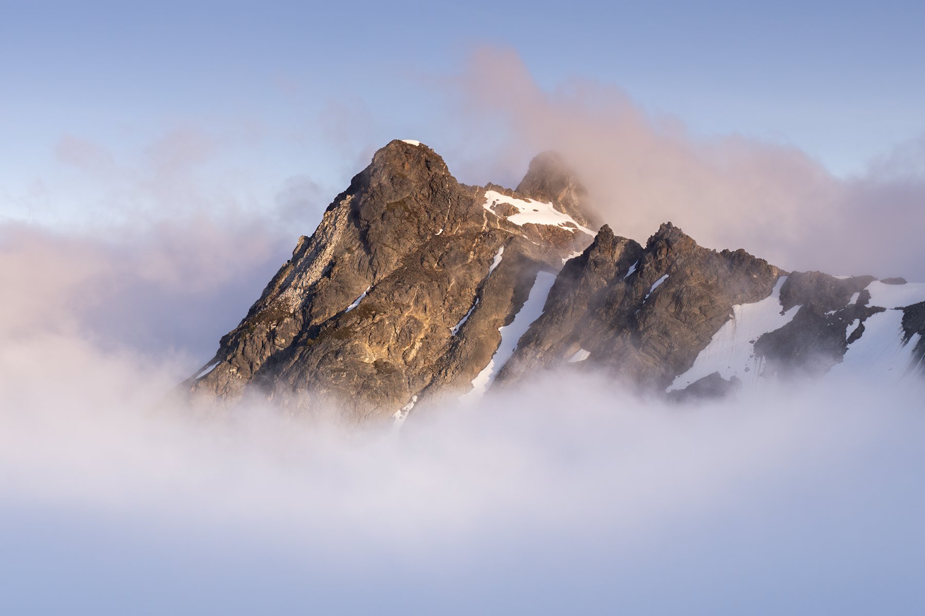
When we arrived at camp, Glacier Peak was shrouded by thick clouds, which was a slight bummer but I knew we had plenty of time to spend with this mountain over the next two days. I could be patient.
After we ate dinner we retreated to our tents, but Alex and I left our tent door open toward the mountain, just in case the clouds cleared. To our delight, about one hour before sunset the cloud ceiling appeared to climb higher and dissipate slightly. We started to get peek-a-boo views of Glacier Peak through tiny breaks in the clouds and eventually the whole cloud evaporated and Glacier Peak was on full display.

Seeing the mountain was impressive, but despite the many miles we had just logged, the summit still looked so far away!
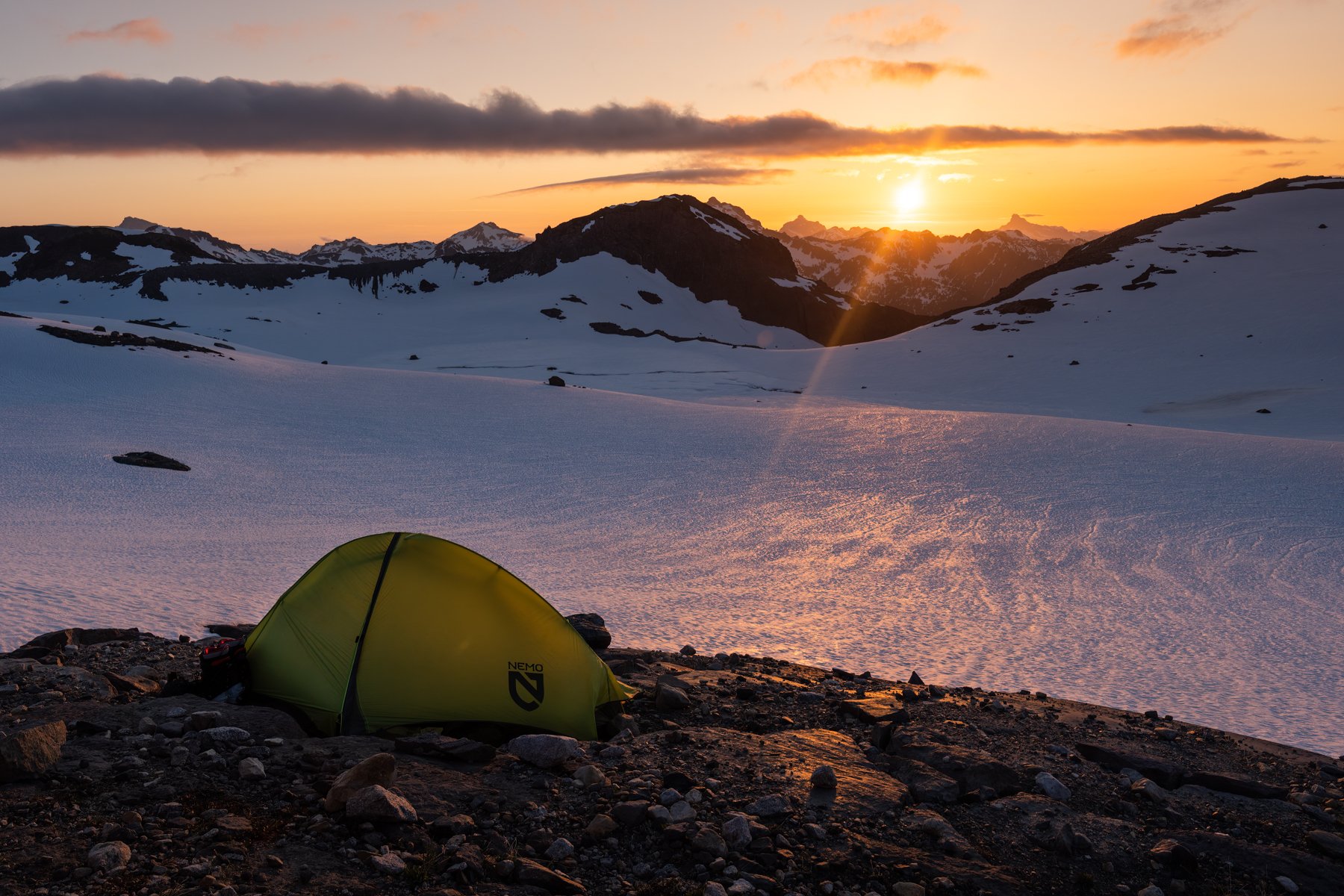
We set an alarm for 4AM and went to bed in the shadow of the mountain we hoped to soon climb.

Day 2: Summit Day
9 miles, 4,400’ gain

Our alarms simultaneously sounded through the silence. I was tired but the excitement for the day quickly pulled me out of my grogginess. I looked outside the tent and was surprised to see a wall of white; the clouds were back. We made breakfast and finalized our packing as the clouds moved in and out. It appeared that we were sitting right at cloud level. We would intermittently be graced with a mountain view only for the veil to drop again.

We started moving at 5:15AM, moving slowly when the clouds descended and navigation became tricky and picking up speed when they lifted and visibility improved.
It seemed that everyone on the mountain had a similar schedule and we almost immediately found ourselves behind a few groups, though it was nice to have a solid track in the snow to follow.
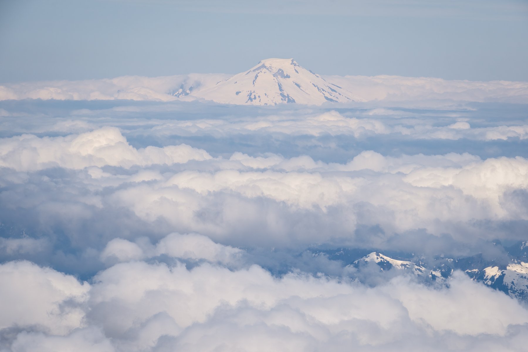
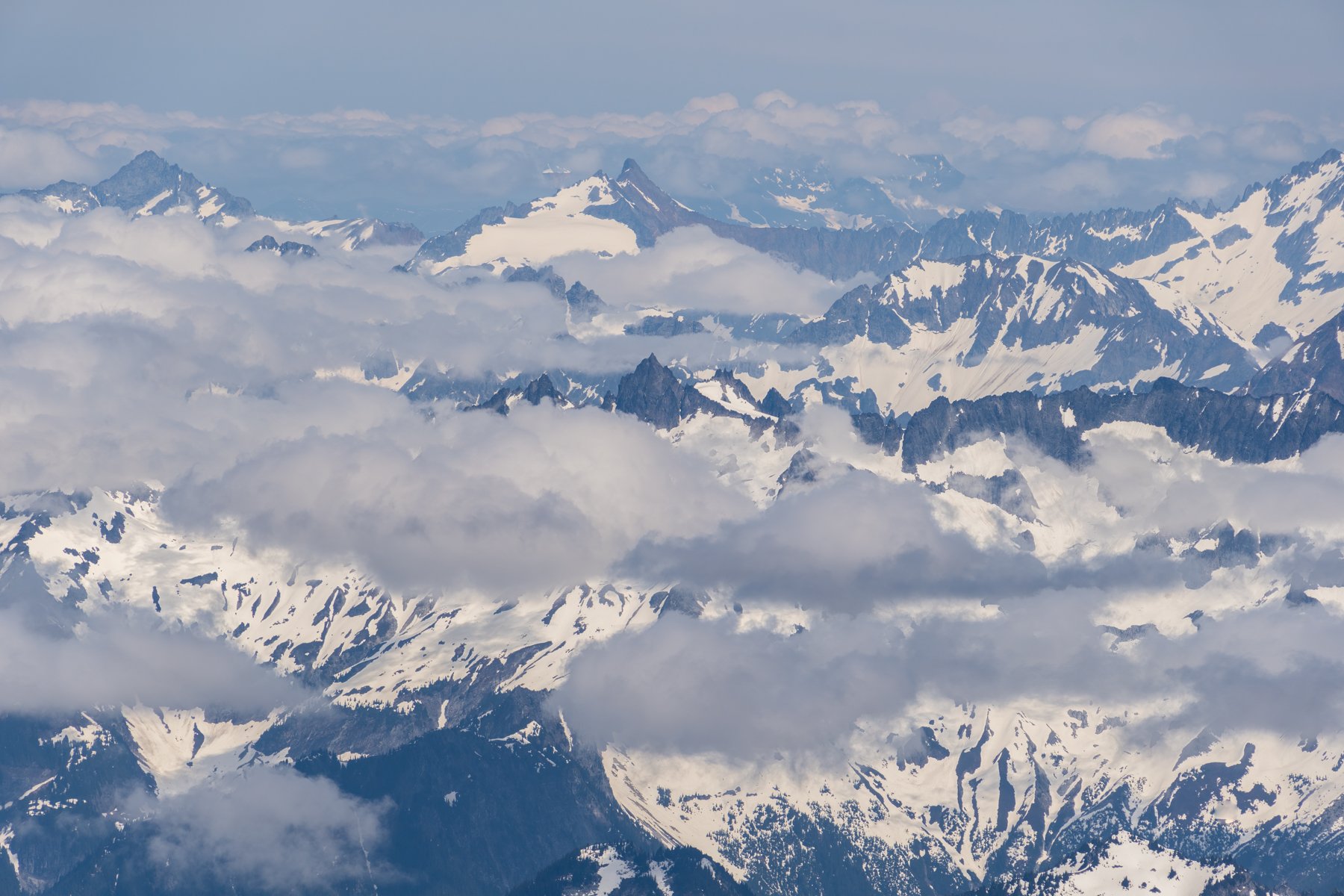
At the Glacier Gap camp we climbed above the inversion layer and were able to take in the views surrounding us—Disappointment Peak appeared like an island on a sea of clouds. Unfortunately, as we climbed another few hundred feet more clouds moved in and we were once again surrounded by a wall of white. I welcomed the clouds’ cooling effect, knowing that eventually we would be in the full glare of the sun with no reprieve.
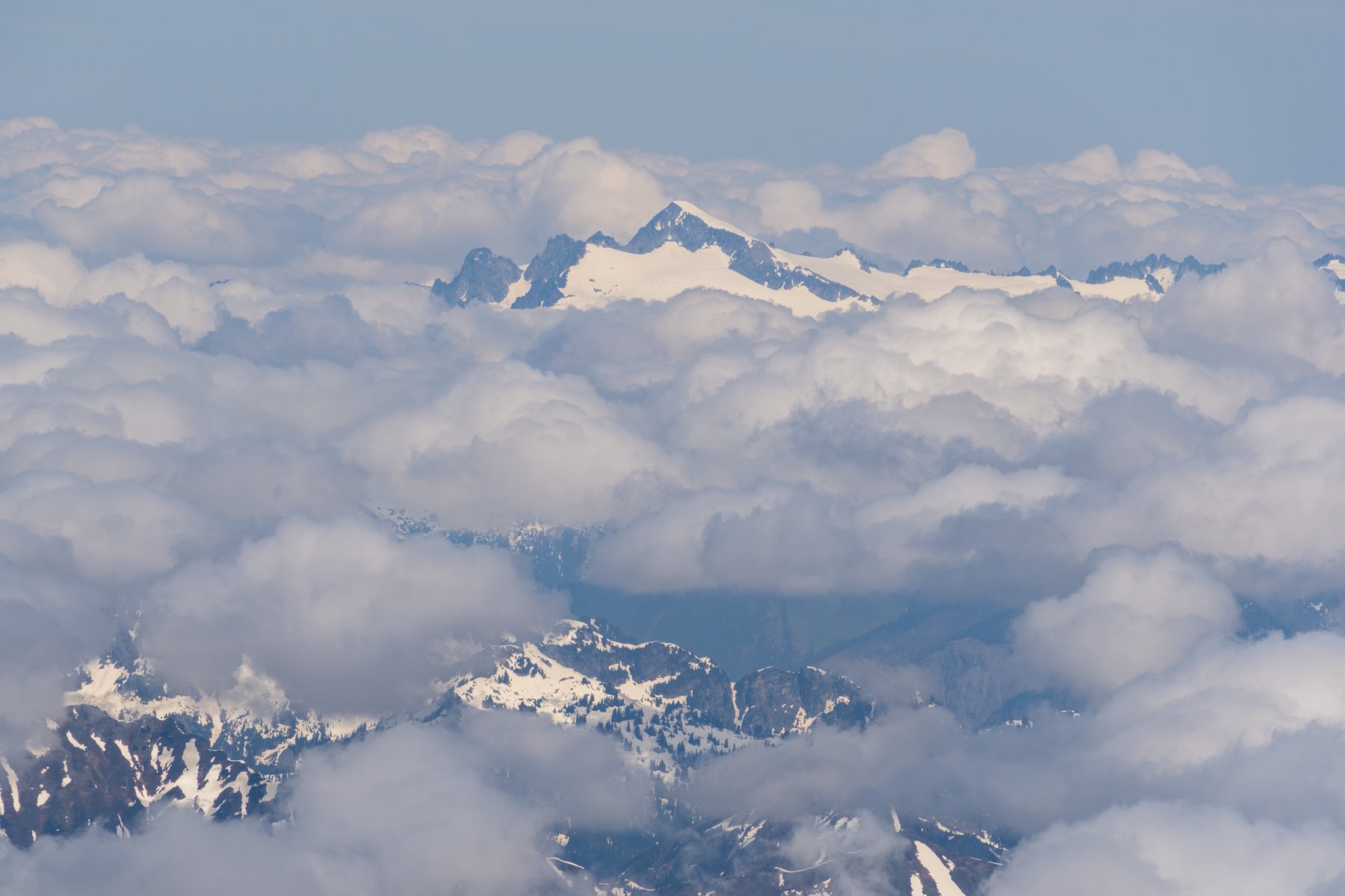
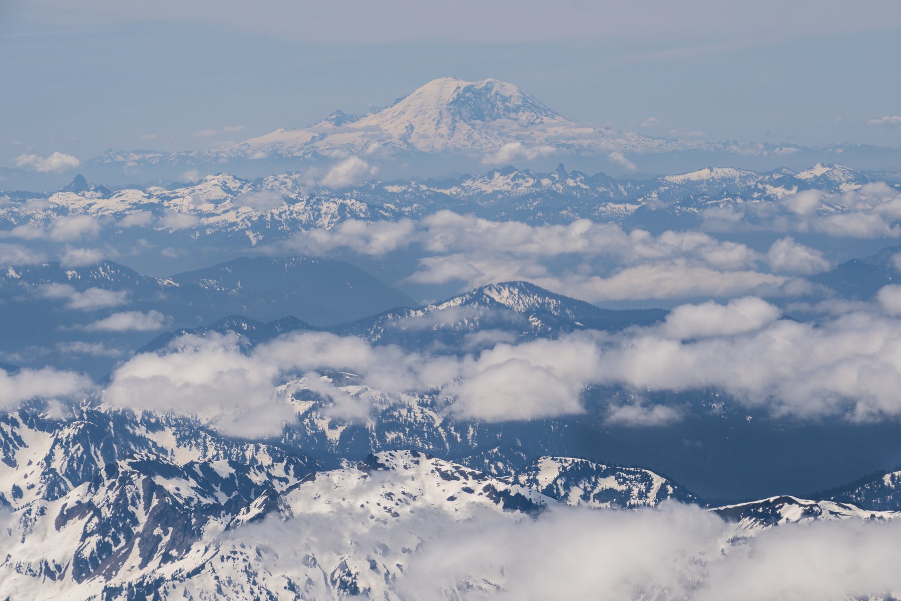
Sure enough, just as we started to hike along the ridge above the Suiattle Glacier we once again climbed above the clouds. For the remainder of the climb we would stay there. Above the clouds, we finally could appreciate the sprawling views offered by our vantage point and they far exceeded by expectations. Glacier Peak’s remoteness in the Cascade range also means that it’s surrounded by mountains in all directions. We could see the famous peaks of the Alpine Lakes Wilderness: Stuart, Daniel, Hinman, and, of course, Rainier was out in all her glory.


Without the clouds to act as a barrier, the sun immediately began to bog us down. I was hot. The snow was feeling too soft for only 8AM. And I was starting to feel the altitude. We slogged on and took a long break at 8,400’. We had over 2,000’ left to climb and still the summit looked so far away.

Our next leg of the day was crossing the Suiattle Glacier and gaining entry to the Cool Glacier. This was by far the hardest section of the day for me. The Suiattle Glacier was relatively mellow, but the final few hundred feet to the Cool Glacier nearly broke me. I was overheating and the altitude was definitely affecting me. Staying hydrated was a chore. I kept adding more snow to my bottle each time I took a sip and quietly called it “free refills” in my head. I had to start counting steps, taking a short break every 50 steps. Sander was sitting at a break spot just 20 feet above me and even then I couldn’t make it to him without taking another mini break. As I sat down and guzzled more water, the tinges of doubt I felt at the trailhead returned. We were still over 1,500’ from the summit but my heart rate kept exploding into Zone 4.

After the break, the three of us continued on. The Cool Glacier was a breath of fresh air compared to the Suiattle Glacier—literally and metaphorically. There was a cool breeze on the east side of the mountain and we cruised up the Cool Glacier at a fraction of the pace we took on the Suiattle Glacier. In just half an hour we were at the top of the Cool Glacier and ready for the summit push.


The final 800’ to the summit had melted out quite a bit, leaving just a few snow patches between the Cool Glacier and the summit. It looked like it was about 50/50 if people took their skis to the summit or opted to stash their gear at the head of the Cool Glacier. We figured we had brought our skis this far, we better take them all the way to the summit and ski from the tippy top, so we A-framed our skis on our packs and began booting up the dusty ridge. We quickly gained elevation and when I looked up I realized that, for the first time all trip, the summit looked within reach.

At 11:45AM, after 6.5 hours of hiking we were standing on the summit of Glacier Peak/Dakobed. The view from that vantage point rivaled the best views I’ve seen in Washington. On the summit, with an unobstructed view to the north, a whole new stretch of mountains was visible to us. All of the North Cascades were out. We could see Baker, Shuksan, Eldorado, Johannesburg, the list was endless. Standing in the center of the Cascades, gazing at some of my favorite areas in the entire world, was overwhelming in the best way. I felt so full of gratitude and appreciation in that moment.

We enjoyed lunch on the summit and soaked in all the views, not knowing when (if ever) we’d be back again.
Finally, we transitioned to ski mode and began our descent. The first few turns off the summit were not my best by any means (the snow was thin and firm) but it was so fun to be able to ski off the summit. Unfortunately, we quickly ran out of snow and were forced to carry our skis down before we could hop back on a second snow patch.
Despite the ski carry, we were back to the Cool Glacier in barely 15 minutes. We repacked the gear we had stashed and skied one by one down the Cool Glacier. The descent of the Cool and Suiattle Glaciers were the highlight of the weekend for me. The snow was nearly perfect corn, the slopes were cruise-y, and the views were unparalleled. We effortlessly whizzed down terrain that took us so long to climb up. I deeply felt the pure joy of skiing in those brief moments.
We were back at camp two hours after leaving the summit. I immediately crawled onto the rocks and laid down. Another cloud had descended and once again Glacier Peak was completely obscured from view. Still, I stared at the spot it would have been and imagined its face hidden behind the clouds. I couldn’t believe we did it!

Day 3: Back to the Trailhead
13 miles, 700’ gain

Day 3 was a retracing of our steps from the first day, except this time it would be nearly all downhill. We knew it would be a much faster day than the first day but we still wanted to get an early start so we began hiking just before 7AM.
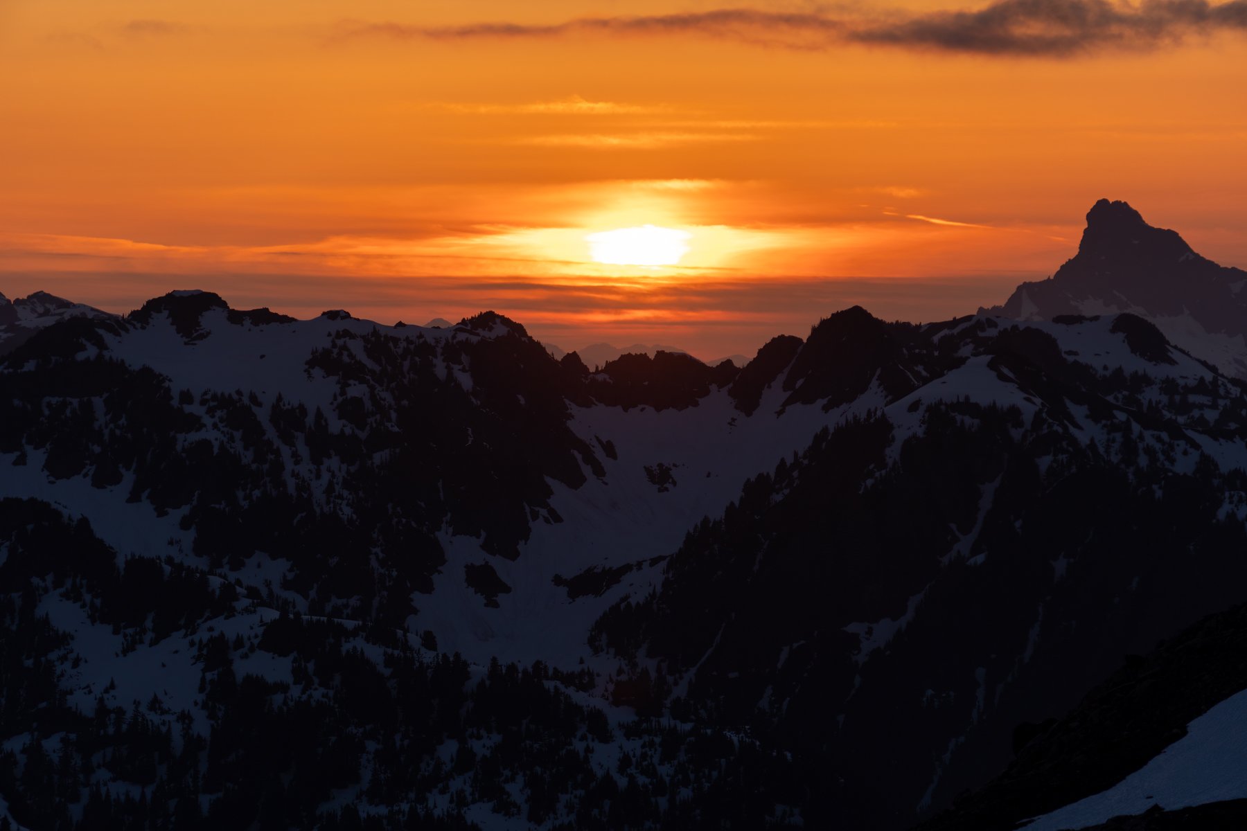
The day had dawned clear, so we were able to enjoy one final, celebratory view of Glacier Peak before turning our backs to the peak and heading for the trailhead.

The first stretch of trail we encountered was a heinous, icy ski downhill just past camp. Doing this first thing in the morning with a fully loaded pack and 85mm skis was bone-chattering—I actually wished for a mouth guard on that run! But it was fast and for that I was grateful.
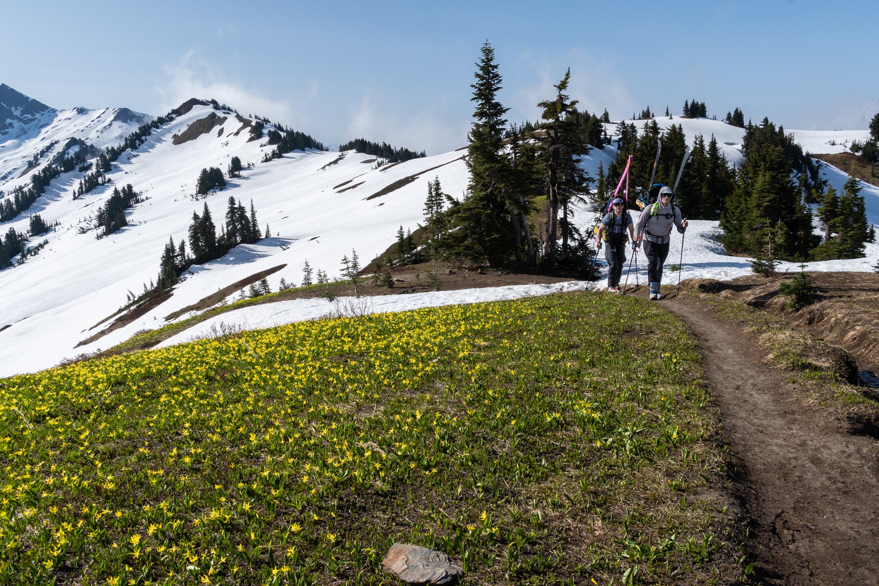
We booted back up to the pass we detoured through on the first day, once again avoiding going around Marmot Knob, and were surprised to find that in just two days there had been quite a bit of melt out on the stretch from White Pass to Marmot Knob. We walked around the dry patches and transitioned back to skiing.


Keeping the highest angle we could manage, we were able to ski continuously from the the pass to just a few hundred feet before White Pass. We were making such good time. Everything seemed easier on day 3.

At White Pass a campsite had melted out so we stopped and took an extended break there, refueling and rehydrating.
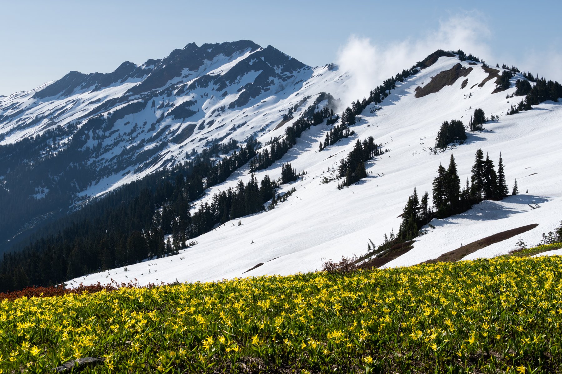
The wildflowers were starting to bloom and were the perfect foreground to the still-snowy mountain peaks in the backdrop. It was a beautiful blending of seasons in one scene.

From White Pass we continued to cruise over the snowfields and across the increasingly broad stretches of dry trail. I couldn’t believe how much snow had melted in just two days. The incessant sun was really doing a number on those south-facing slopes .
The 26 switchbacks were also much faster on the way down, but those final five meandering miles on the trail were sneakily difficult. We had completed all of the hard terrain—the glaciers, the steep switchbacks, the side-hilling, the icy snowfields with long run-outs—all we had left was five miles of undulating trail through a beautiful forest. It should have been easy, but those miles seemed to drag on forever.

Sander, Alex, and I all fell into our own paces. Sander zoomed on ahead, I stayed in the middle, and Alex in the back.

After just under 7 hours, I finally saw the glint of cars through the trees. Sander was already laying on a foam mat next to the car, lounging with his shoes off. A few minutes after I arrived, Alex exited the forest.
We did it. We spent three wonderful, challenging, beautiful, exhausting, amazing days in the Glacier Peak Wilderness. We stood atop the fourth tallest peak in the state, enjoyed skiing down glaciers, and pushed ourselves in challenging terrain. I am so grateful for this peak and this experience. Dakobed is truly a special mountain.
*****