
A Failed Objective in the North Cascades

DATE HIKED: 8/20-8/21/22
TOTAL MILEAGE: 15 MILES
TOTAL ELEVATION GAIN: 5,200’
RED TAPE: BACKCOUNTRY PERMITS ARE REQUIRED TO CAMP IN NORTH CASCADES NATIONAL PARK. RESERVATIONS CAN BE MADE AT RECREATION.GOV OR OBTAINED AS A WALKUP PERMIT UP TO ONE DAY BEFORE THE TRIP DATE.
A season spent hiking and backpacking in the North Cascades wouldn’t be complete without at least one failed objective. After a pretty successful summer run, Alex and I experienced that failure on an attempt to make it to a pair of pretty alpine lakes nestled under Mt. Arriva and Fisher Peak. The final approach to the lakes is known to be pretty sketchy, with multiple route descriptions mentioning a “gully of death” and cautioning hikers to be careful about their route selection. Alex and I had a big traverse planned in the North Cascades over Labor Day weekend so we were looking for a route that would test us—a route that required boulder hopping, route-finding, and scrambling with a heavy overnight pack. The scenic Silent Lakes seemed like the perfect challenge with a pretty reward. Unfortunately, while we experienced the challenge, we did not get to experience the reward, but we were in such a beautiful area that the trip didn’t seem like a total wash despite not making it to our objective.
We picked up our backcountry permit first thing Saturday morning and then made our way along the stunning Highway 20 until we reached the Easy Pass trailhead.
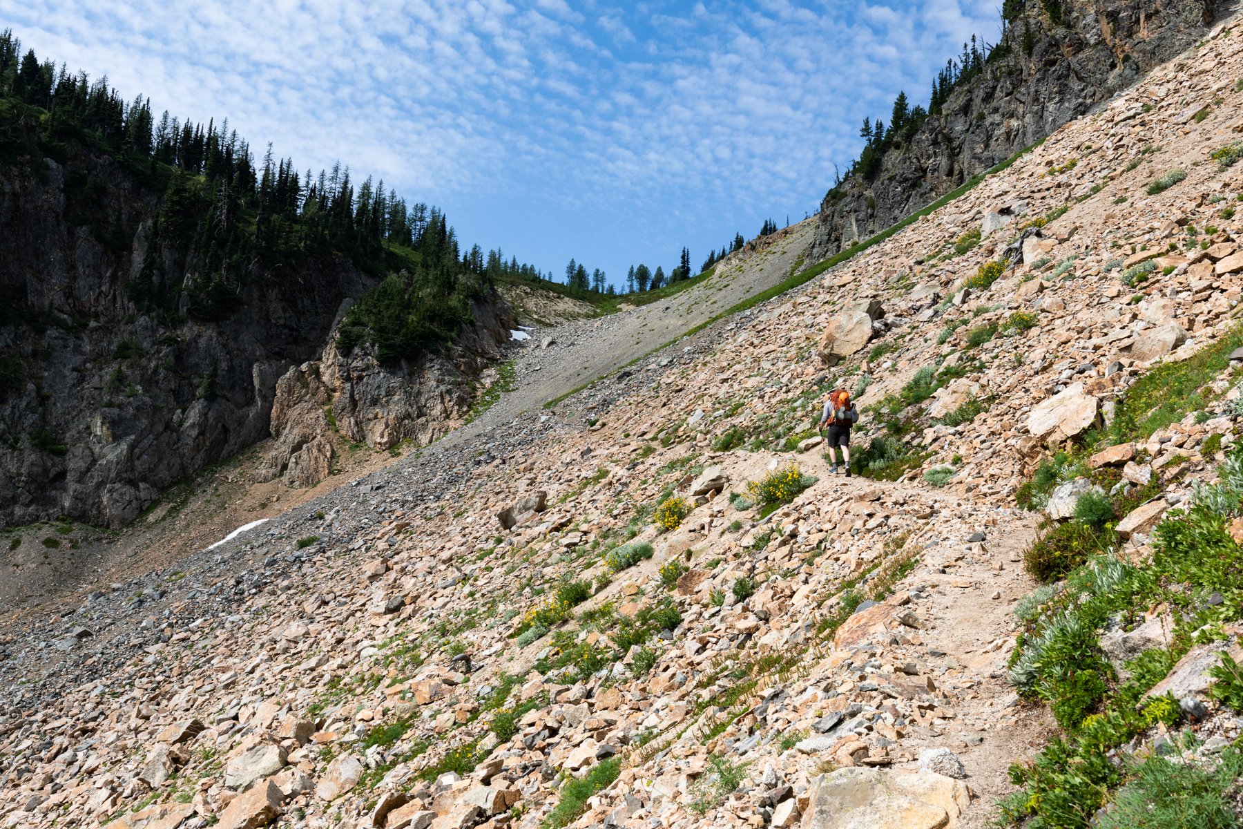
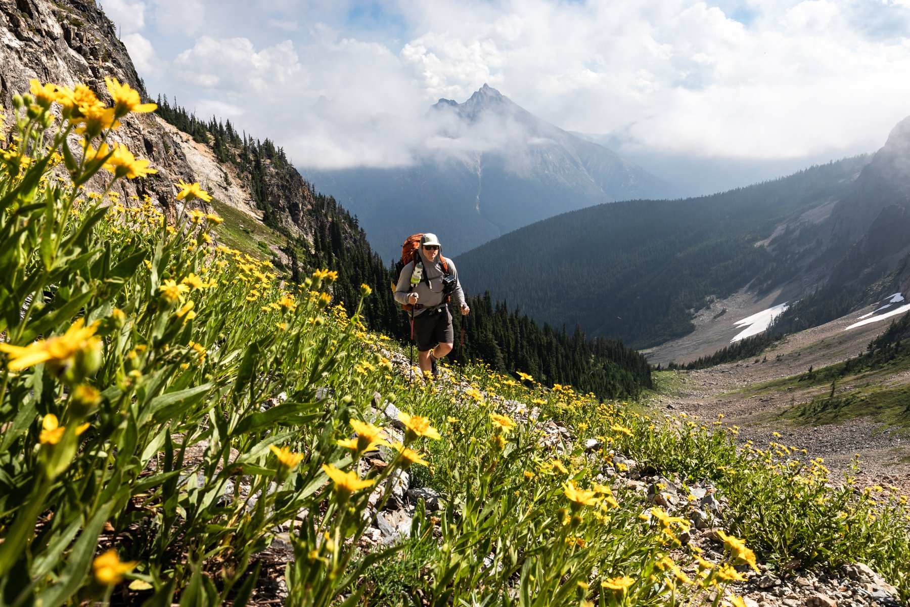
The trail started with a couple of easy, cruiser miles until we reached the base of Easy Pass where we encountered our first climb—about 1,000’ in one mile on exposed, rocky switchbacks. As we made our way up the views around us began to open up and we were serenaded by meeping pikas and grasshoppers that sounded uncannily like sprinklers as they hopped from rock to rock.
We reached Easy Pass—the boundary between Okanaogan-Wenatchee National Forest and North Cascades National Park—in two hours. The name “Easy Pass” seems like a little bit of a misnomer, though. Moderate Pass may have been more applicable!
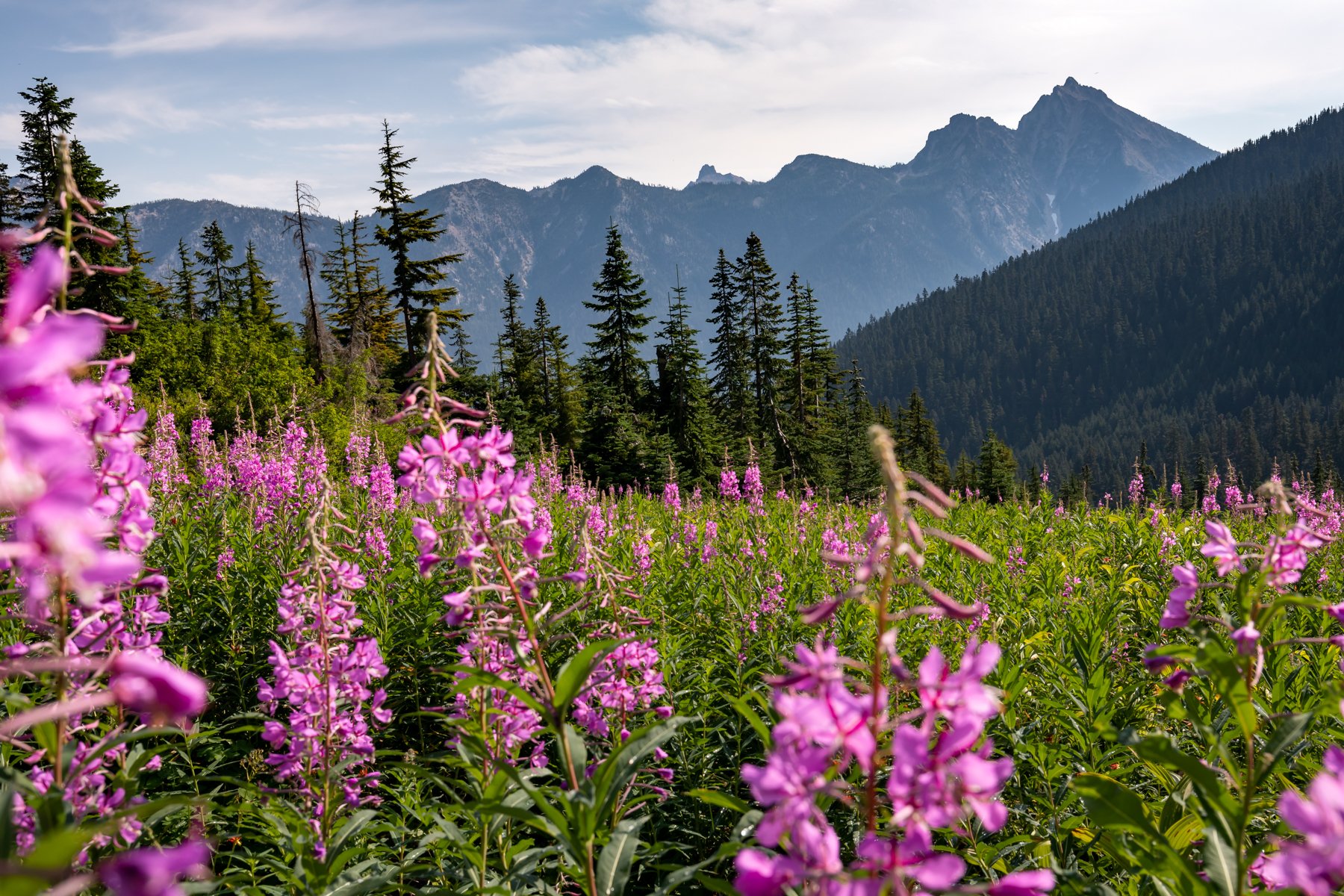
From the pass the views to the north and west opened up spectacularly. Fisher Peak sat at the head of the snake-like Fisher Valley that wound its way past recognizable mountains like Black Peak, Katsuk, and Mesahchie. Wildflowers peppered the meadows with shades of pink, purple, and white. It was tough to make progress when we stopped on every switchback to take photos of either the mountains or the flowers, but eventually we were cruising down to the floor of the valley.

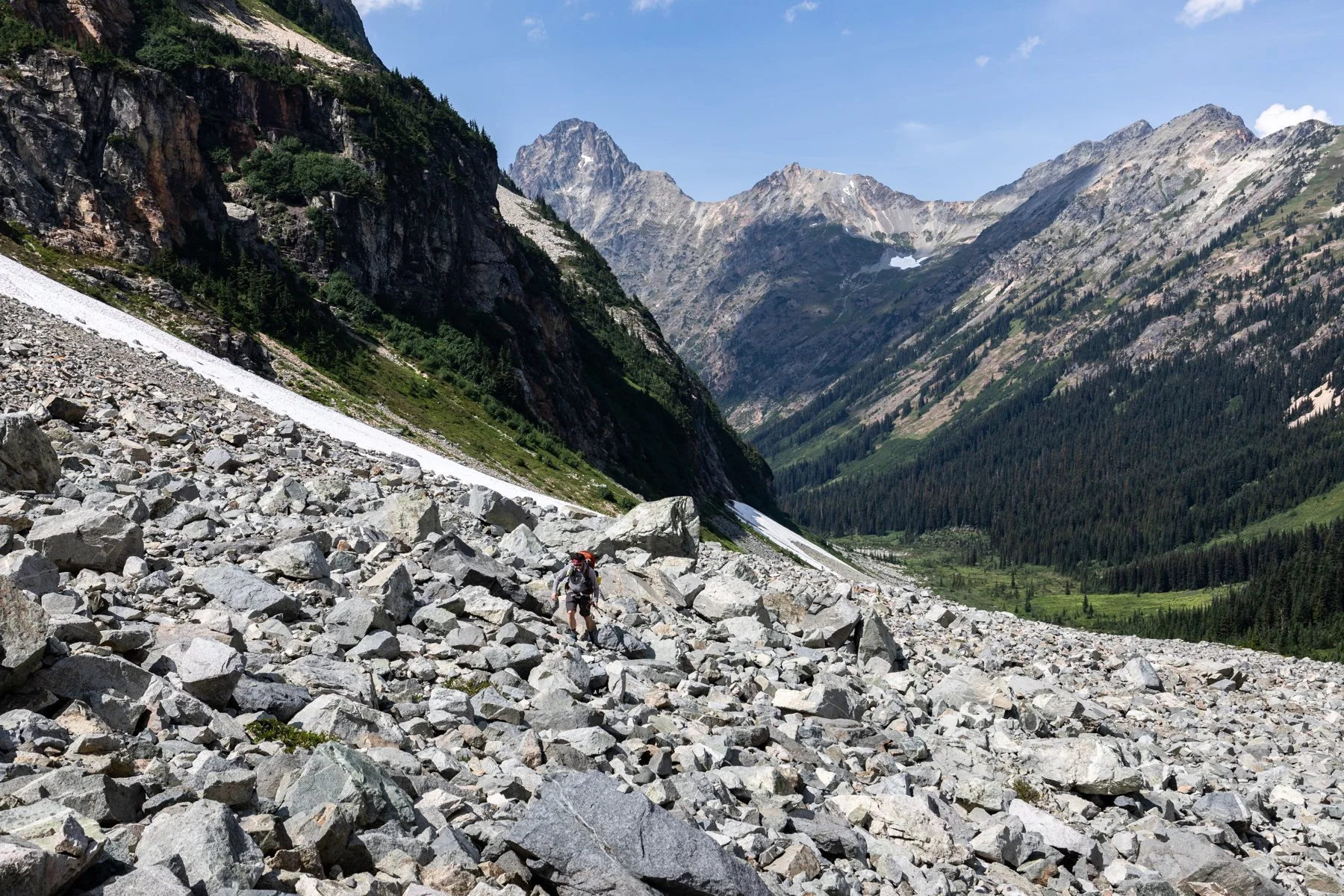
After we reached Fisher Camp we turned onto a climber’s trail. The remainder of our route was no longer following established trails so we were expecting to have to do a fair bit of route-finding and navigation, but we were pleasantly surprised to find that the climber’s trail was well-trodden and we were able to maintain nearly the same pace we had on the established trail. That was, until we reached the boulder fields. We knew the boulder fields were coming and their dreaded arrival was just as bad as we had anticipated. For over one mile we gingerly traversed rock after rock, just hoping that they held their place and didn’t catapult us forward or shift and crush our feet.
While traversing the boulders, we ran into another couple who were also attempting to make it to Silent Lakes, with the additional goal of scrambling up Fisher Peak the following morning. We took a few breaks and chatted together as we collectively headed up the valley.
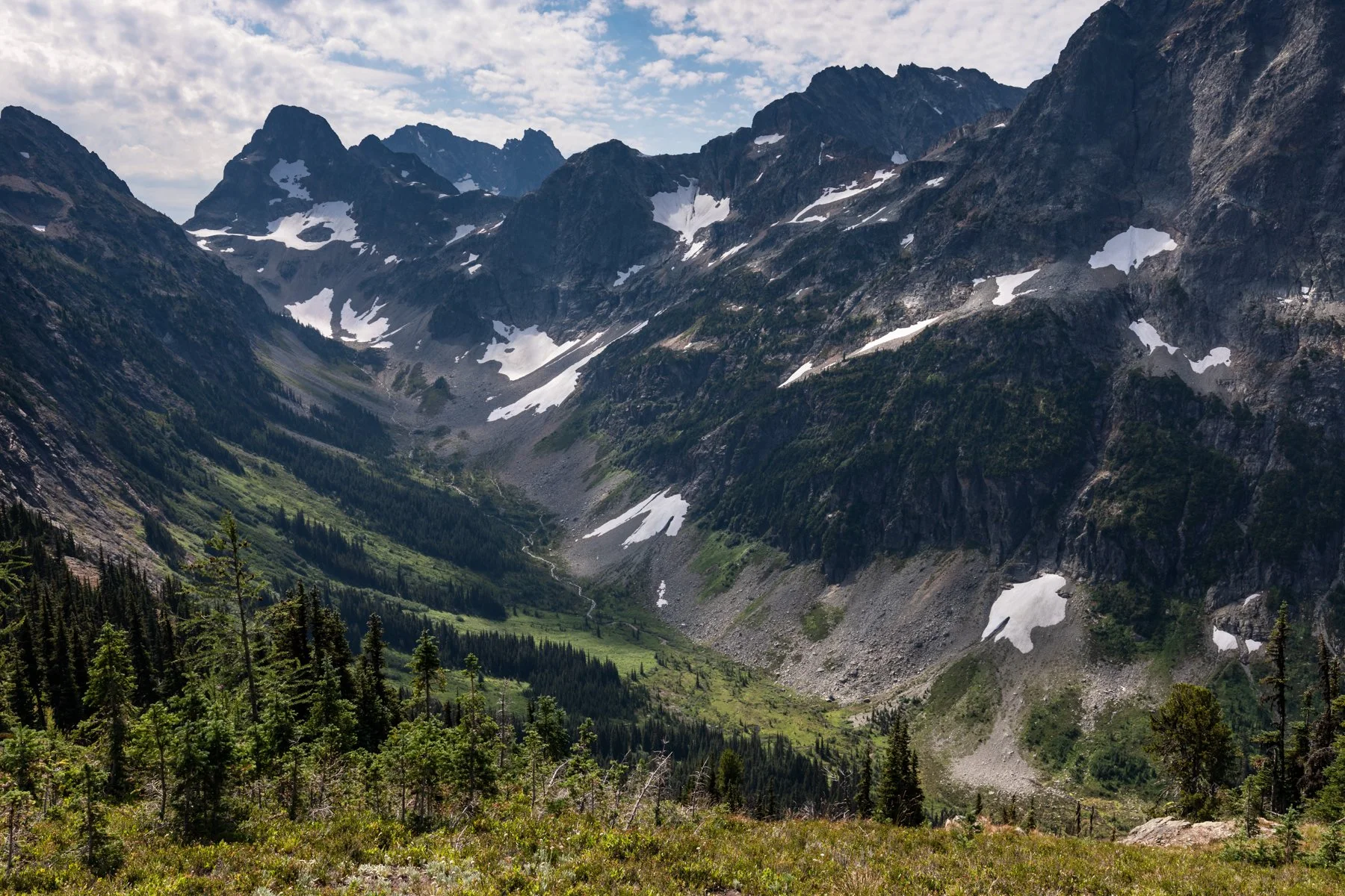
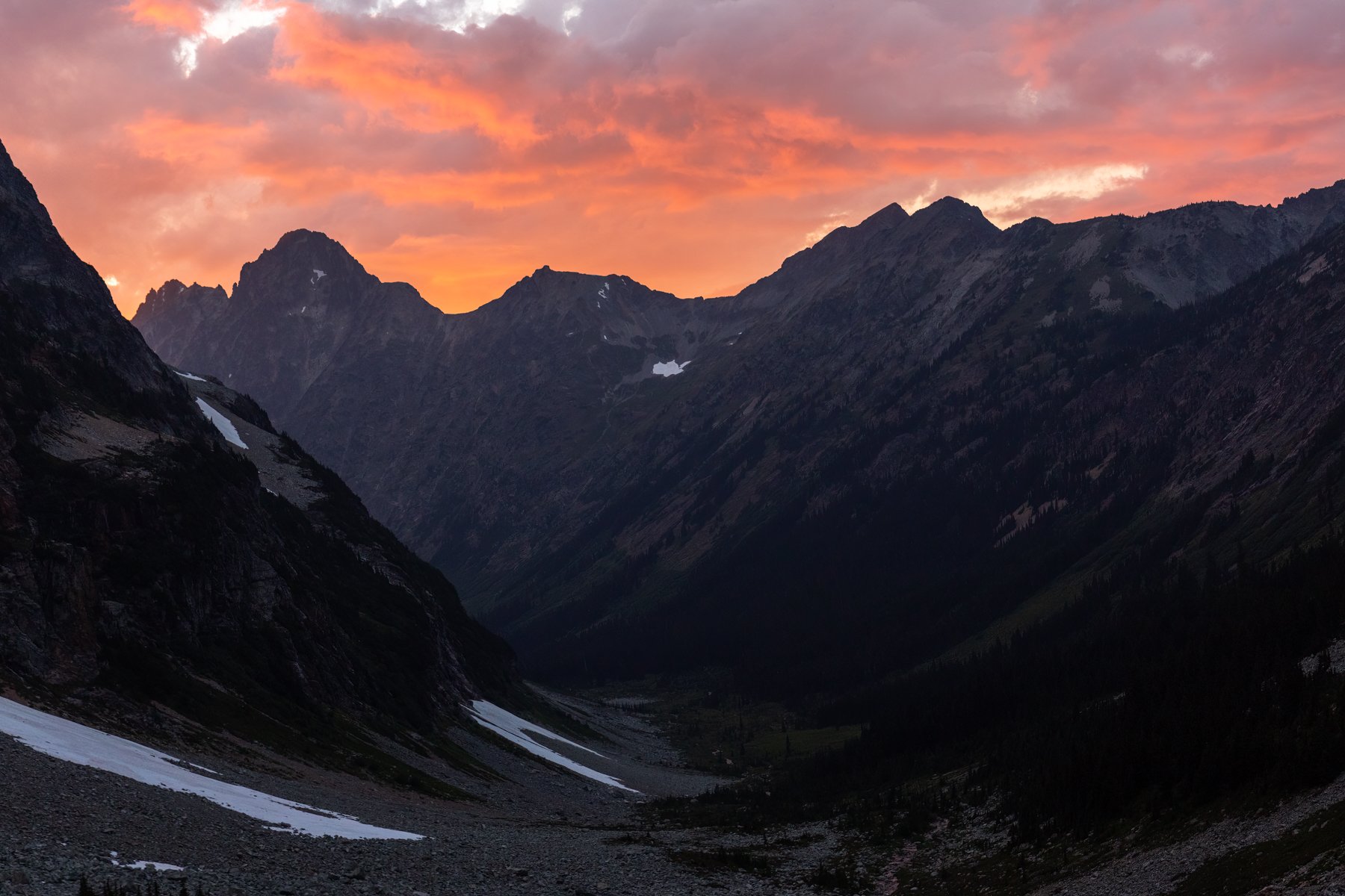
We made it to the head of the valley in five hours and our route options were clear before us. First, was the aforementioned “gully of death,” and it did look tempting—it was so straight forward!—but it was also extremely steep and narrow and rock fall would be a constant concern. The “heather ramps” that trip reports confirm is the best route didn’t immediately stick out to us, but there did seem to be a weakness in the wall of cliffs. Our final option was right at our feet—a beautiful campsite overlooking the Fisher Valley, very likely made by others who saw the route up to Silent Lakes and decided to just camp in the valley for the evening.
Our new friends headed out first, to try to suss out the correct route while we finished filtering water before the final push. We watched them make their way up an impossibly steep and unstable rocky slope, their steps sent huge rocks careening below them, some the size of bowling balls! They disappeared around a ledge and just a few minutes later appeared on top of the cliffs. They gave us a thumbs up and an enthusiastic “it goes! This is the route!”
Alex and I looked at each other, the route seemed out of our comfort zone. We can do steep. We can’t do crumbly steep. Still, we wanted to at least see the terrain for ourselves before making the decision. We put our helmets on and made our way to the base of the slope. The rocks shifted with every step I took. Some shifted only an inch before settling, but some didn’t have any sign of settling and I had to move my feet lest they be smashed by avalanching rocks. Alex and I regrouped under a giant boulder and I decided I would scramble up a little higher to see if the route got any better. On all fours, I crawled up the slope, willing the rocks to stay still beneath me. The terrain did get easier and I was soon about 30’ above Alex and nearly to the ledge we just saw the other two disappear around. I had hoped I would peer around the corner and see the start of the heather ramps, but my heart sunk when instead I saw another steep crumbling slope. The start of the ramps were approximately another 30’ above me, they were so close, yet the terrain seemed too out of our comfort zone. I turned back to Alex, “I think we should turn around.” He agreed.
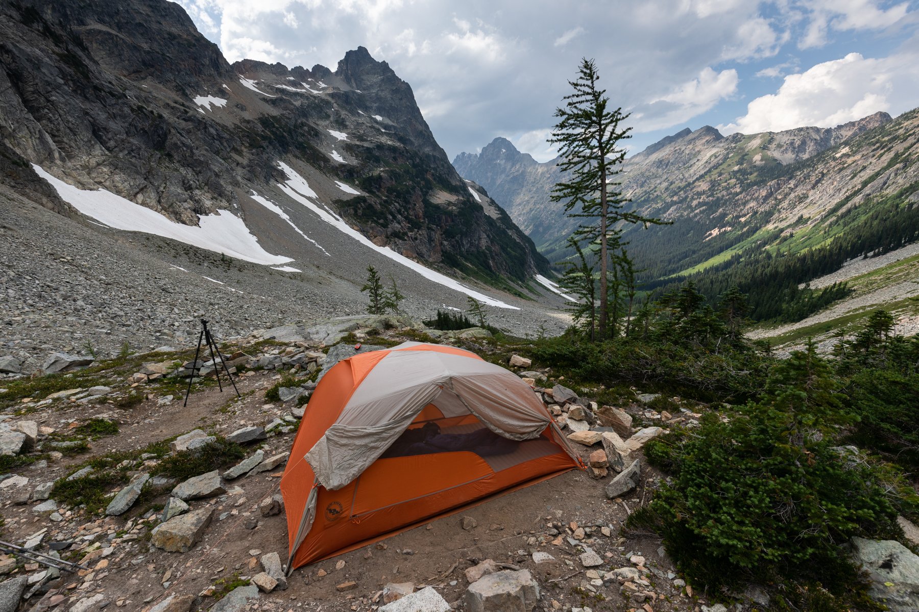
Back at the campsite I felt disappointed but relieved. I knew the views from the top would be beautiful, but something deep inside of me had been skeptical of this route since we saw it from Easy Pass. In addition, it looked like rain was on the horizon and that route was not one I would want to do if it were wet. We set up the tent and crawled in, I stared out the tent door and let my thoughts wander.
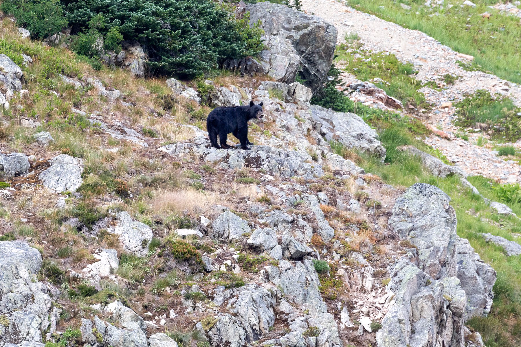
My thoughts were jolted back to reality when I heard the sound of something large rustling outside. I sat up, instinctively yelled “HEY!” and jumped out of the tent. I looked around outside, trying to find the source of the noise and saw movement on a grassy slope across from us. A black bear was ambling its way up the slope into a stand of trees. Alex got out of the tent and we both yelled “AY-YO!” The bear reappeared on the opposite side of the trees a few minutes later and stared at us. We waved our hands and yelled some more. The bear seemed unfazed, its head down, staring at us in an unsettling way. Its ears weren’t back and it wasn’t making any snapping motions with its mouth (sure signs of an agitated bear), but it still wasn’t reacting as we would have hoped. After a few moments it turned away and began making its way up toward a pass at the very head of the valley. For exactly 32 minutes we watched the bear make its way up and over the same terrain we had just contended with, and the bear made it look so easy. By the time it reached the pass it had shrunk down to the size of a nearly imperceptible black dot. Had we not known it was there we never would have known a bear was walking up the slope! It was an impressive display of how efficiently bears can move through mountainous terrain.
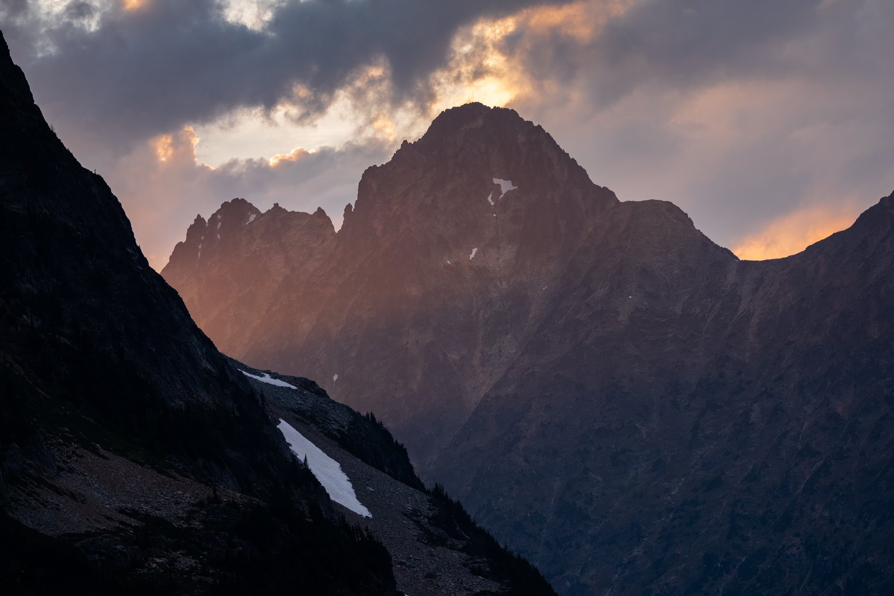
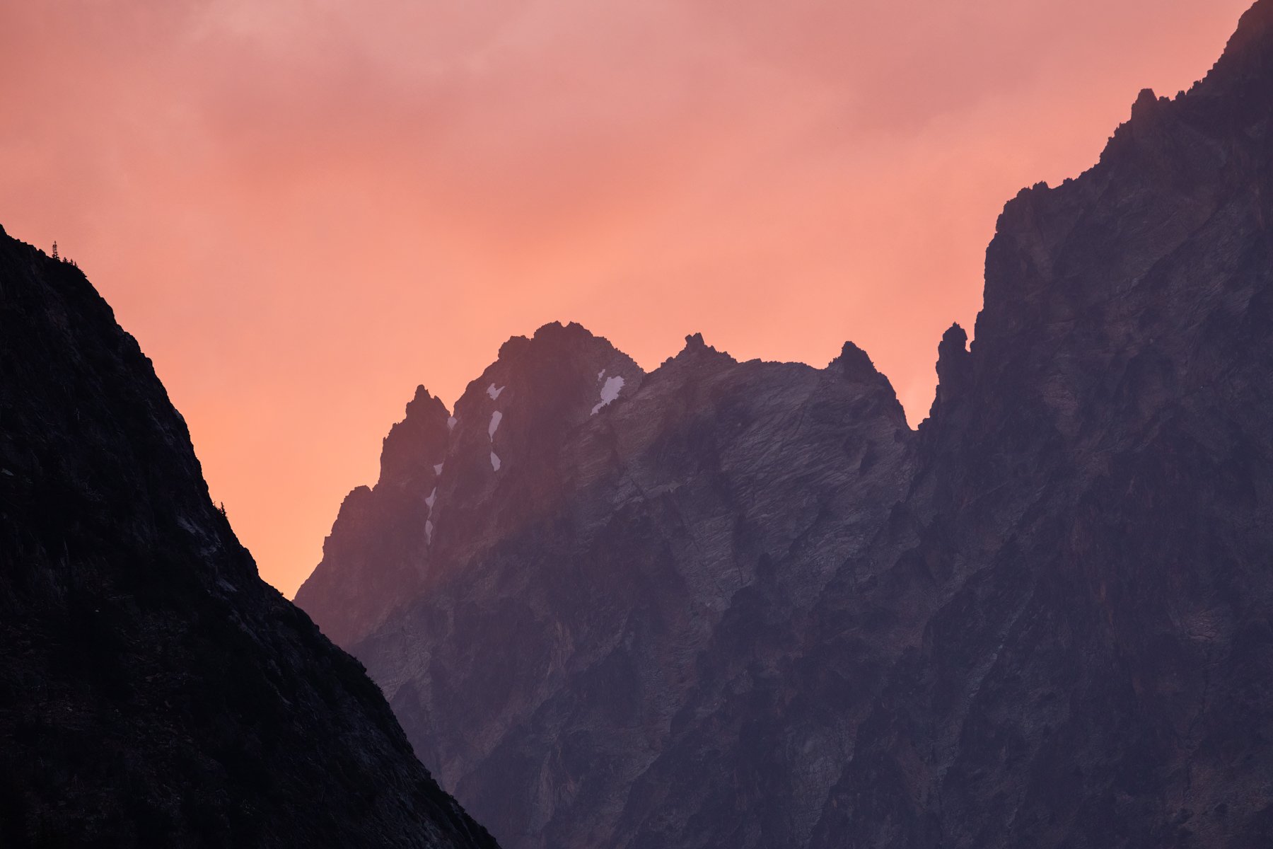
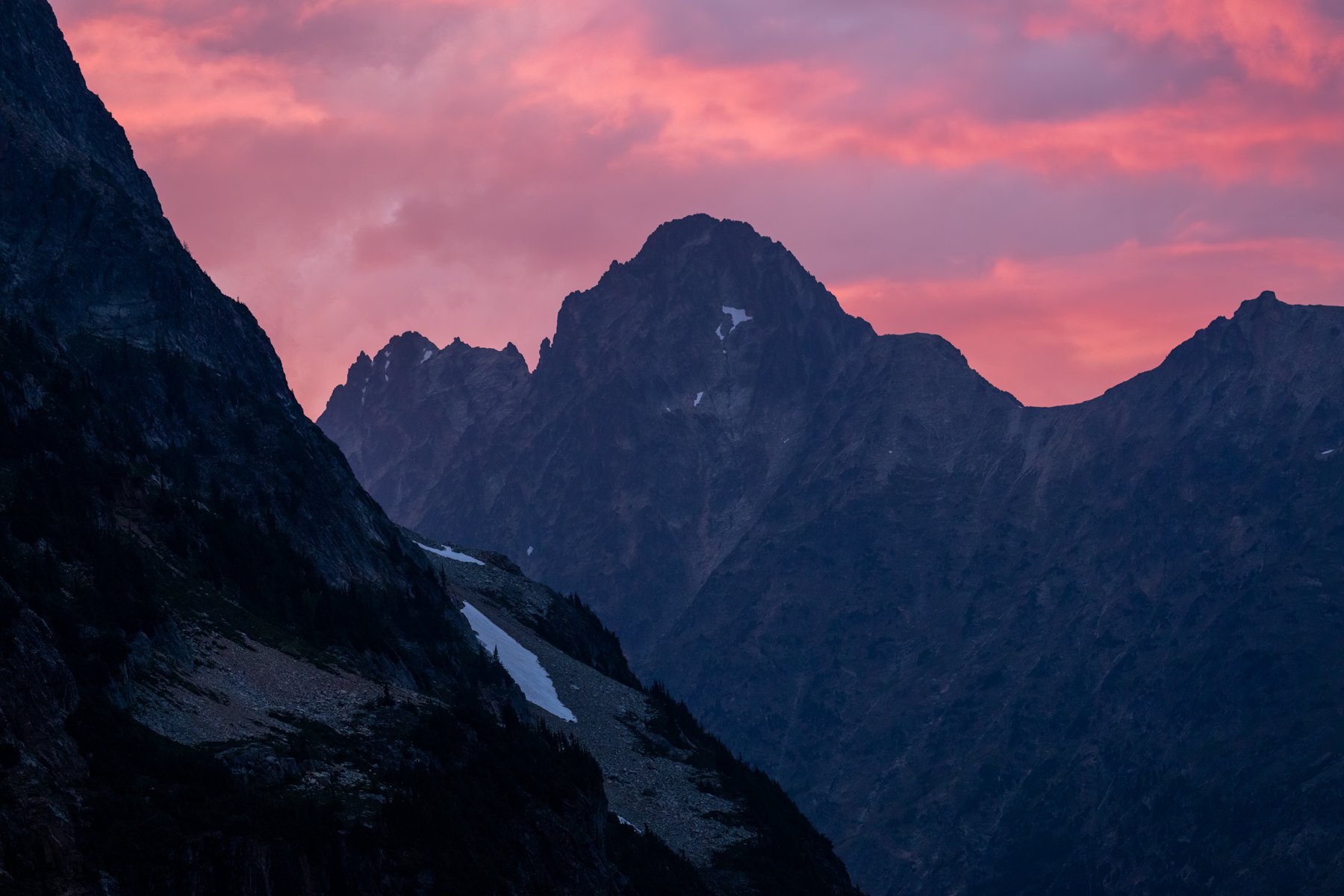
The sky continued to darken and any lingering hope I’d had for a colorful sunset disappeared. We retreated back to the tent, the adrenaline of the bear encounter prompting me to sit up every minute to peer out the tent to make sure the bear hadn’t decided to descend back down into this valley. Just when I thought the day would fade to gray, Alex commented on the lightest tinge of pink on the bottoms of the clouds. I grabbed my camera and headed out the tent. As we watched, the tinge of pink started to brighten until the whole sky glowed a vibrant shade of fuchsia. It seemed to defy physics that the valley could be so bright, but I enjoyed every second of the show.

When the color began to fade—this time for good—we retreated to the tent for the final time that day, just in time for the clouds to open and the rain we had been expectantly waiting on all afternoon to start. The rain and wind lulled me into a deep sleep.
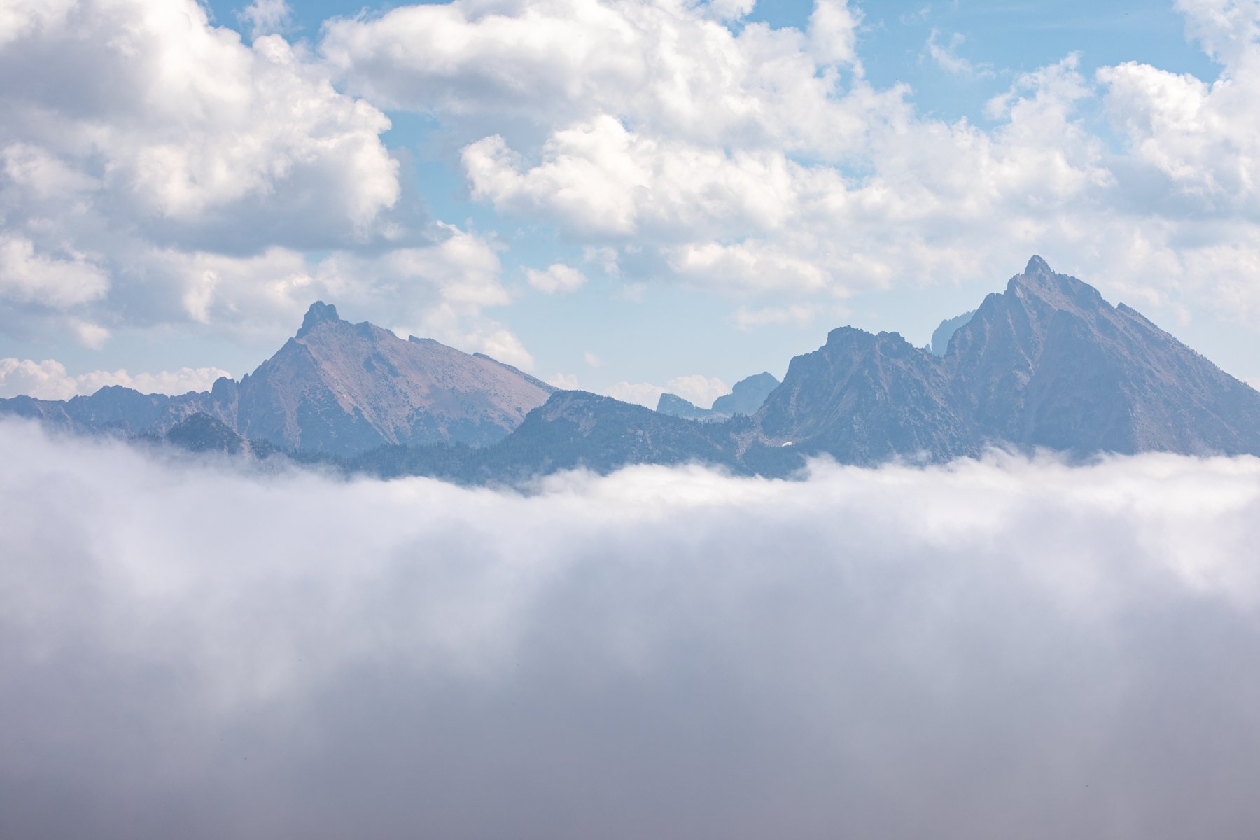
The next morning dawned bright and white. We found ourselves surrounded by a cloud, with little visibility in any direction. This further validated our decision to not make it up to our objective. However, unbeknownst to us, the cloud layer was only a few hundred feet above us and had we made it to our destination we would have been treated to the most otherworldly inversion layer (this was confirmed by photos and Instagram stories from the couple we met on the trail).
We packed up in a wet mist and began to descend back into the valley we had arduously ascended the afternoon prior. The boulders were now slick with water and the already difficult terrain became even more sketchy. We picked our way down the boulder field and into the meadows. My legs and feet were absolutely drenched.
We celebrated finally making it back to Fisher Camp and the junction with the real trail. Now we just had one steep ascent before we could cruise on out. The thick clouds still had not budged as we made our way up to Easy Pass. As we ascended, it seemed as if the cloud ceiling was growing thinner, the change was barely discernible, but it was enough that when we got to the pass I suggested we take a break to make breakfast. In our haste to leave camp, we didn’t make a hot breakfast and instead ate some energy chews to buoy us up the trail.

Once at the pass we set our packs down and I pulled out the stove and our breakfast. As we were beginning to boil water the clouds began to sink. Intermittently, they offered us views of the surrounding peaks, sitting like islands in the clouds. Then, like a veil, the clouds dropped altogether. All of the peaks sat prominently on a bed of clouds. It was tough to know which direction to look because everywhere I turned offered a new and unique view. Our breakfast was nearly forgotten while we ran around taking photos and timelapses (for Alex).
Eventually, we had to pull ourselves away from the pass and make our way back to the trailhead. I had been looking forward to hiking into a cool cloud once we descended to the east side of the pass, but the heat of the day seemed to evaporate the clouds and soon we were hiking in the bright sun again.
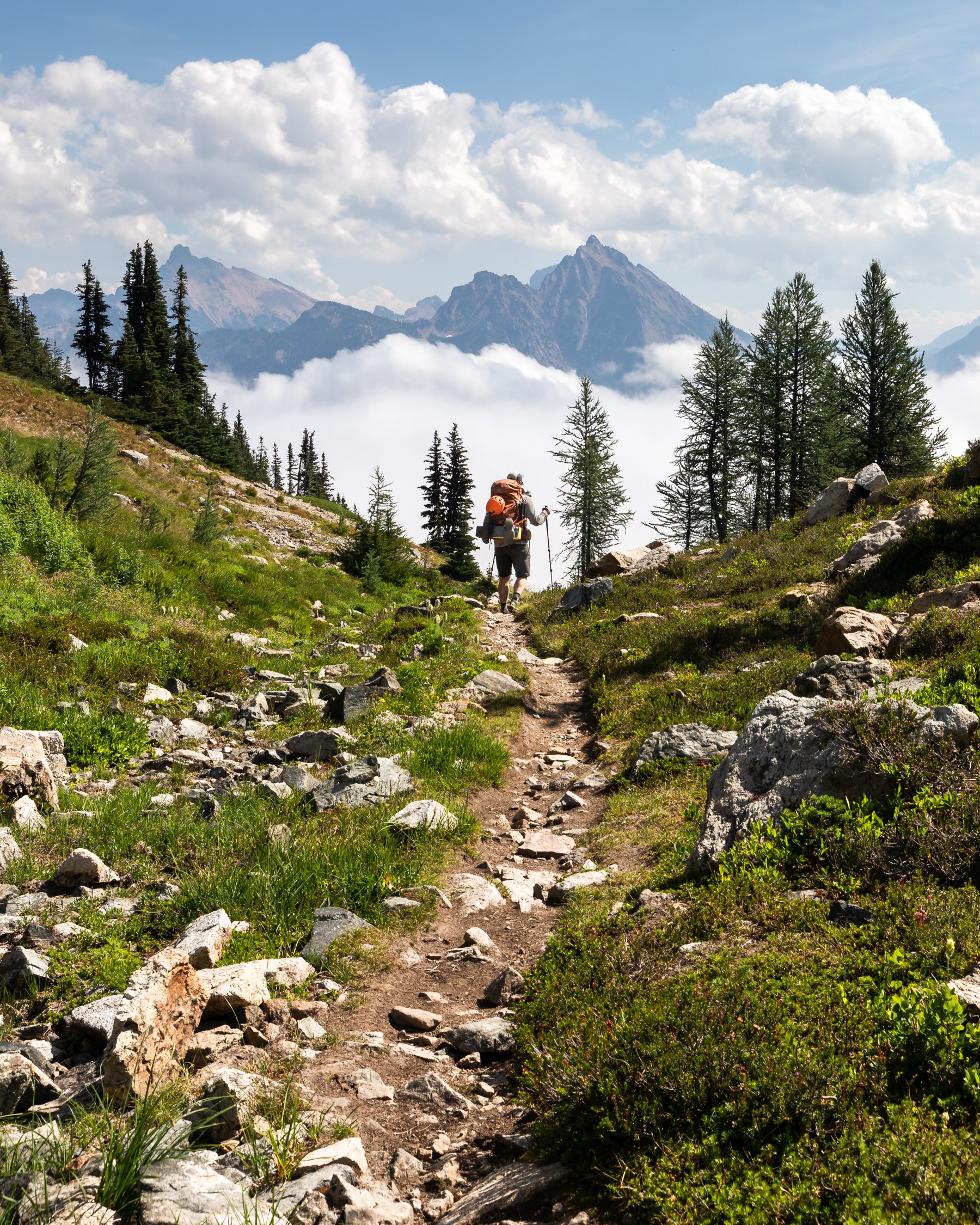
The hike back to the trailhead was fast. Once we were in the forest the views diminished and the trail leveled out to a grade that was optimal for quick miles.
We may have not made it to our original destination, but I feel as if this trip has been the most successful fail we’ve had yet. Despite the setback, we still experienced incredible views, a beautiful campsite, and we did extend the edges of our comfort zone, even if just slightly. So often when we don’t reach an objective I write the entire experience off as a loss, but this one I still count as a win!
