
Telaquana to Turquoise: Backpacking in Lake Clark National Park

7/3/19 - 7/7/19
“So do we turn back?” I asked the group, disappointment echoing in my voice. Everyone averted their eyes, staring off at the horizon or down at their feet. I knew it was inevitable: we had to return to camp. It was simply too hot to hike, the brush too cumbersome to bushwhack through, our nerves too frayed, and our exhaustion too high. We turned around. It was the fourth day of our five day trip through the Lake Clark backcountry and by heading back to camp we were only forgoing a day hike but I still felt guilty. The knowledge that I may never visit this place again weighed heavily on me. Looking back now, from the comfort of my home in Seattle, I know we made the right decision.
Alex, Gabriel, Andra, and I planned this traverse of Lake Clark’s wilderness in December of 2018. I met Gabriel and Andra online nearly two years ago when they emailed me to ask a couple questions about Gates of the Arctic. We emailed back and forth and realized we had the shared goal of visiting Lake Clark in the future, we put the idea of a group trip in the back of our minds and kept in touch over the months. Then, in December I reached out to them and asked if they would want to join Alex and me this summer on that trip we had only spoke about briefly, and they said yes!
When we were in the early planning stages of the trip I had been worried the notorious Alaskan rain would leave us tent-bound for days on end. I never would have guessed that it would be the sun and intense heat that left us confined to the tent, but that’s exactly what happened. Alaska experienced a record-breaking heat wave during the 5 days we were in Lake Clark. Each day was in the 90s and each day we hiked in the smothering heat of high noon. Water sources became an issue. The summer came so hot and fast that the high temperatures had already evaporated the snowfields that typically melt slower and leave water sources at more regular intervals. By the time we arrived these water sources were long gone, everything but the lakes and two glacial-fed creeks was bone dry. This left us rationing water, futilely consulting our map from a 1954 survey, and uttering the words “it’s dry” and “there’s no water here” over and over.
Despite the heat and unreliable water sources the trip was nothing short of spectacular. From the moment our small plane’s wheels lifted off the ground in Anchorage we were treated to unbelievable view after unbelievable view. As we were whisked from Anchorage to Port Alsworth on a 45 minute flight we passed over a sea of mountains and glaciers. For as far as the eye could see the landscape was filled—both horizontally and vertically—with massive chunks of rock and ice.

Plane taking off from Port Alsworth, bound for the backcountry
In Port Alsworth we purchased fuel and bear spray, gave our backpacks one final go over, and stopped at the park Visitor Center to speak with a ranger about current conditions. It was still early morning but it was already hot. The forecast for the week may have been record-breaking but I still couldn’t resist packing my down jacket, gloves, and a thick hat. I trusted the forecast but I also didn’t want to be unprepared if the weather changed on a dime, something that was prone to happen in Alaska.
Finally, it was time to board the float plane. We all piled into the plane’s cramped body, the pilot gave us a brief safety talk, and within moments we were airborne, hurtling higher and higher into the mountains until the town looked like nothing more than a child’s toy below. Like the flight from Anchorage to Port Alsworth, our flight from Port Alsworth to Telaquana Lake was stunning, but this one also gave us a preview of the route we would be taking the following days from Telaquana Lake to Turquoise Lake. From the air the route seemed simple, everything on the ground was compressed, 6’ tall trees looked like turf and boulders looked like pebbles. This shouldn’t be too bad, I let myself think.

Twin Lakes from the plane
We landed at Telaquana Lake in some of the bluest water I’ve ever seen. Our pilot navigated over to the shore and dropped us off on a narrow, lonely beach before climbing back into his plane and bidding us adieu. The moment the drone of the plane had faded into the silence the reality of our trip finally hit me. However, instead of being apprehensive about the prospect of traveling through trail-less terrain, like I have been on past Alaskan backcountry trips, this time I felt only excitement.
According to the park service’s website, the first leg of this trip—bushwhacking from the Telaquana lakeshore to above the treeline—would be some of the worst terrain we would experience, and we could expect two to five hours of hiking through thick brush before we would be free of it. The website was correct. The bushwhacking was rough, the forest seemed to push back against us every step of the way. Our progress was slow, but in just over two hours we finally broke out of the brush and into the squishy tundra. We still had a few hills to climb but hiking on the tundra was much more enjoyable than fighting the alders.
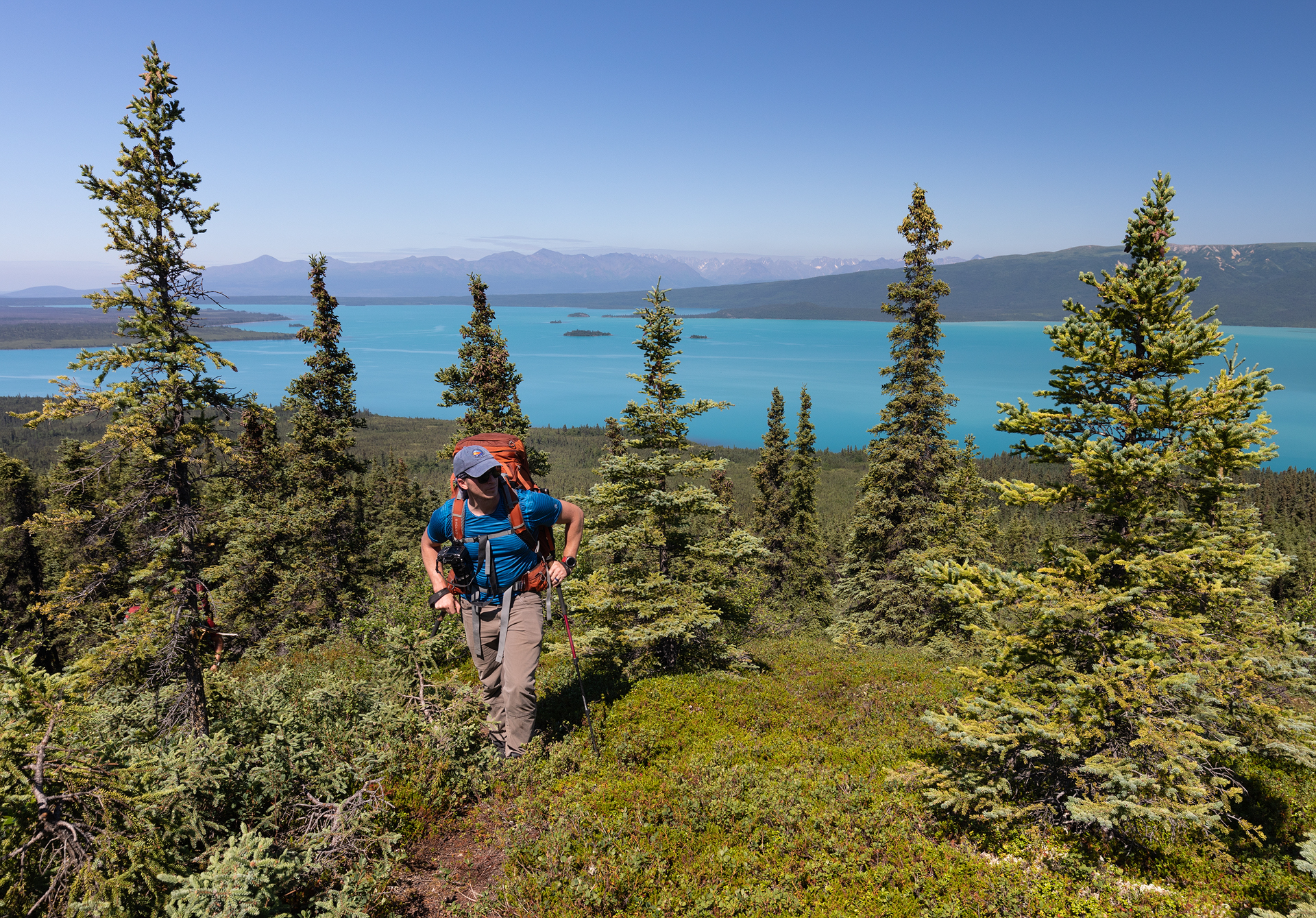
Alex just as we broke above the brush
We ran into our first water scare shortly after breaking above the brush. We looked around and realized everything was dry. Depressions in the grass hinted at recent ponds and streams but, for the time being, the water holes were a distant memory of the land. I pulled out my topo map and Gabriel checked his Garmin. We both noted a relatively large lake that was no more than a mile ahead of us. We headed toward it, hoping that it was real and that there would be camping nearby. Each time we crested a ridge, thinking we had reached the final ridge, a new one would materialize before us. As we climbed higher we got more anxious about the water. The more distance we put behind us the farther we would have to backtrack if this lake was dry. Thankfully, we eventually made it to the top of the true final ridge and a sparkling pool of blue came into view. It was beautiful—perfectly clear and deep. We quickly found suitable camping spots and set up our tents.
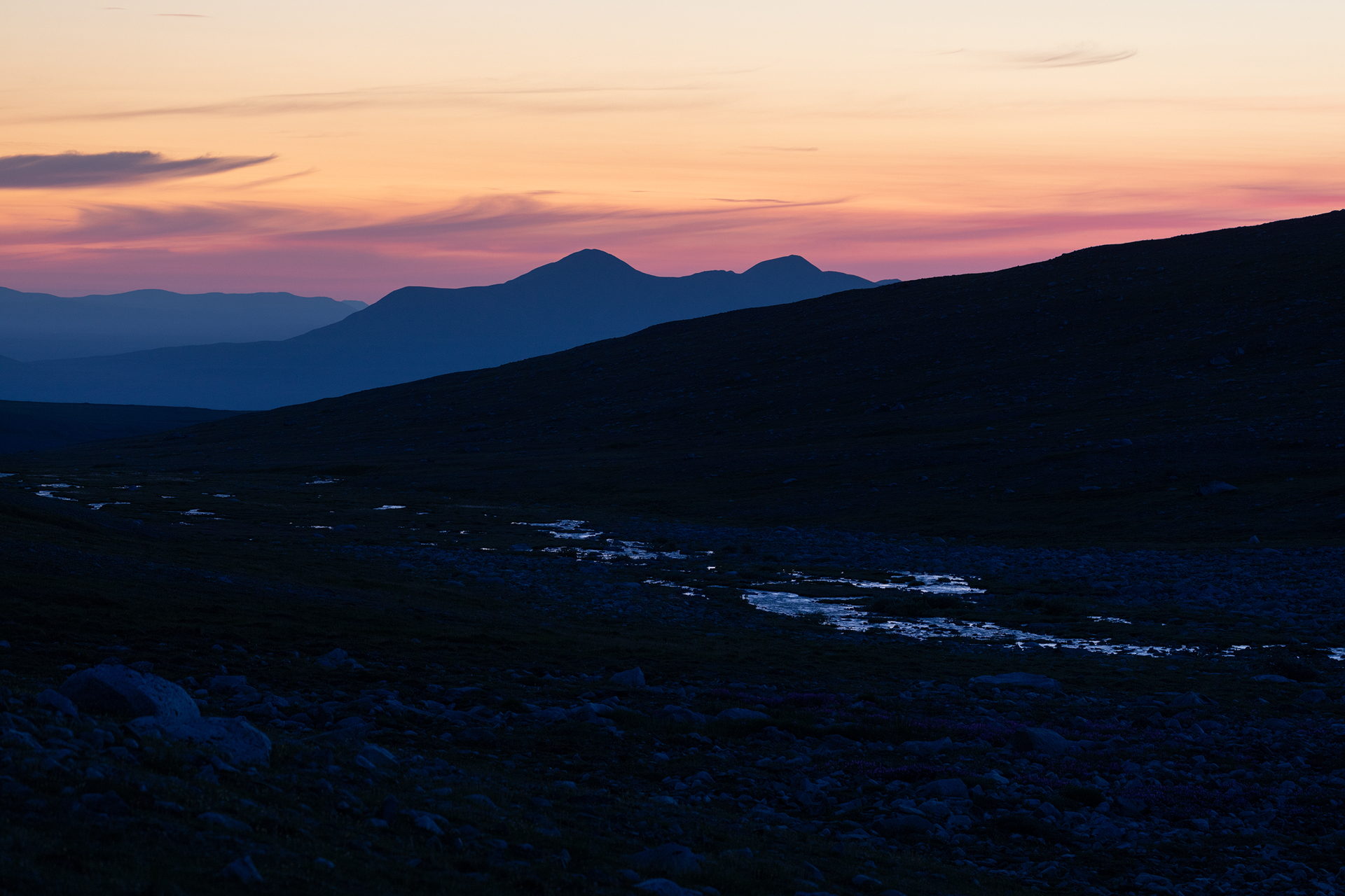
I was exhausted from the long day of travel and hiking so I went to bed shortly after dinner. I had no intentions of waking up for sunrise, but Alex came back into the tent at 4am and shook me awake, “look at this, this is what it looks like outside right now!” he exclaimed as he handed me his phone. His screen was illuminated pink and orange by a spectacular sunrise that was unfolding just outside the tent walls. I’m usually not a morning person but that woke me up faster than any coffee ever has. I jammed by feet into my Crocs, stumbled out of the tent, and made my way down to the lakeshore—or it was more of a pondshore, in reality. The mountains reflected perfectly in the calm water, framed by vibrant sunrise-soaked clouds. I lingered around as the sky got brighter and eventually returned to the tent when the mosquitos became too much of a nuisance. I promptly fell back asleep for another three hours.
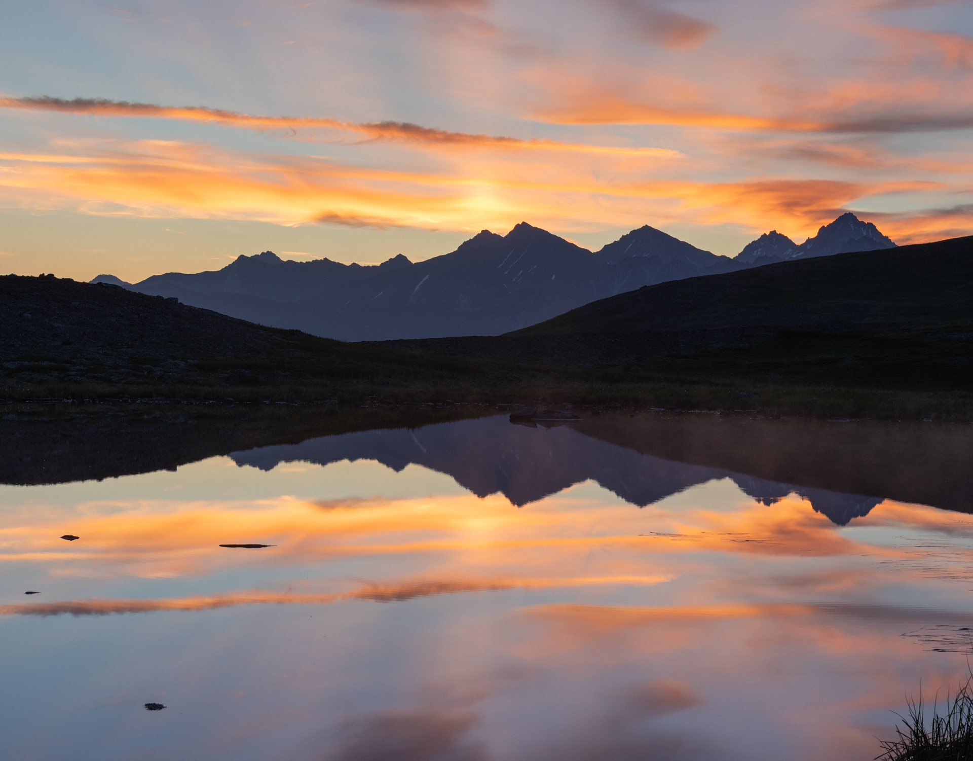
Sunrise from a small pond near our camp
We didn’t have any set daily destinations for this trip. The park website even encourages hikers to take each day as it comes and have a “you get where you get” attitude. We looked at the map and saw a promising spot that would put us about halfway to Turquoise Lake and also set us up nicely for a day hike the following day. We aimed there.

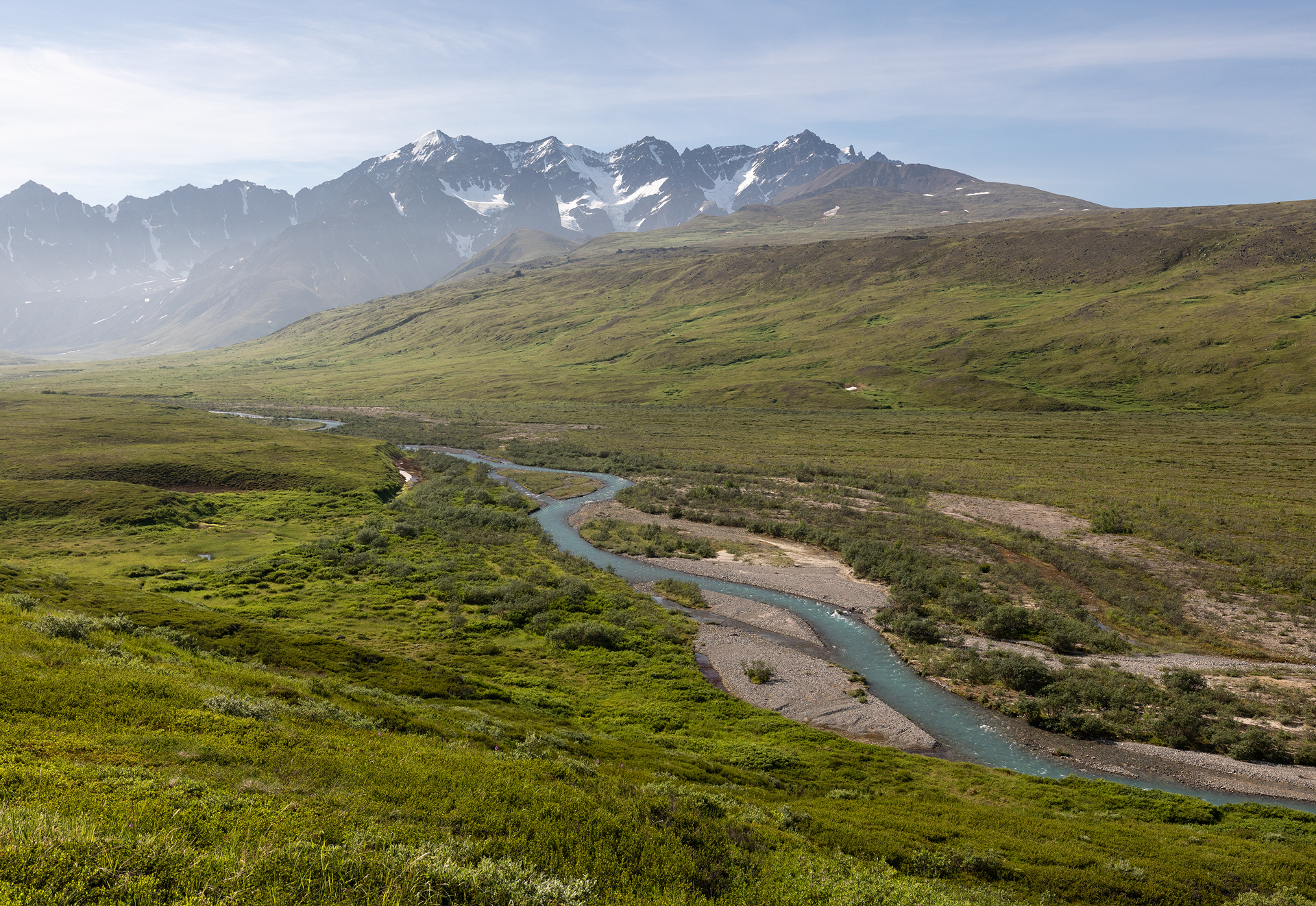
Trail Creek down below
Day two took us up and down a few valleys. It was a little discouraging to get to gain a ridge, see the valley floor 1,000’ below and see the next ridge directly across from you, but up and down we went. We crossed Trail Creek early in the morning, which was good because the creek swelled with each passing minute as the sun melted the glaciers that fed right into it. From Trail Creek we went up and down another dry valley that once again set our nerves on edge. Would there be any water at our proposed camp? We kept our hopes up but were preparing for the worst—a much longer hike than anticipated in order to find water.
Finally, we made it to the top of another hill. Andra ran on ahead, she turned around and smiled “I think that’s water!” I walked over and agreed. The creek looked low, but it was running water, betrayed by the sun reflecting off of its sinewy bends. We practically ran down the steep embankment toward the creek. The water was silty, not a prime water source and not great for our filter, but it would work. Once again we found flat spaces to camp and set up our tents.

Camp near Telaquana Mountain
The late sunsets gave us the luxury of time. We took an afternoon nap, lazed at the creekside and soaked our feet, and Gabriel and Andra even had enough time to take a short stroll before we even thought about dinner. We went to bed before sunset but Alex and I set alarms for midnight so we could see how golden hour was progressing. Somehow we both missed the alarm. I woke up at nearly 1am assuming I had missed the show but there was still color in the sky. The scene was spectacular: the creek was faintly illuminated in the inky shadows of the valley and pink and orange clouds painted the sky. I headed to bed to catch a few more hours of sleep before, once again, I was up for sunrise.
Our plan for the third day was to day hike to Telaquana Glacier and then return to camp to pack up and move on. The hike to Telaquana Glacier started out easy with a walk through the valley, but once we reached the rock pile at the head of the creek our pace slowed to a halt. Gabriel and Andra were much lighter on their feet and made quick progress through the unstable rocks but I plodded along behind everyone. The map wasn’t detailed so we weren’t sure what sort of treasures, if any, the upper reaches of the valley would hold, but it was fun to set out and explore. After about 40 minutes Gabriel called back to us, “I see a lake!” I had hoped that there would be a glacial lake in the valley but didn’t want to set any expectations for the hike. The lake was a silty brown, dammed by the massive pile of rocks we had been hiking over all morning, but it sat below the jagged peaks of the Telaquana massif and was a sight to behold.

An unnamed tarn on our day hike
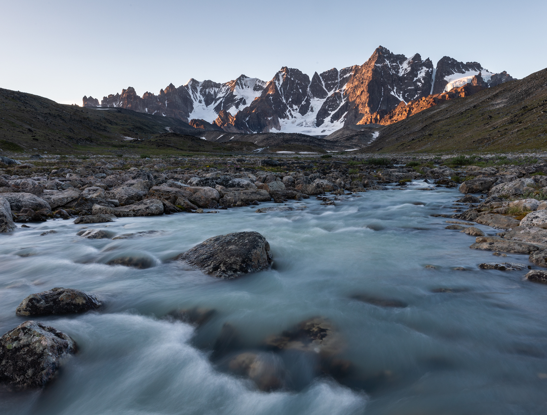
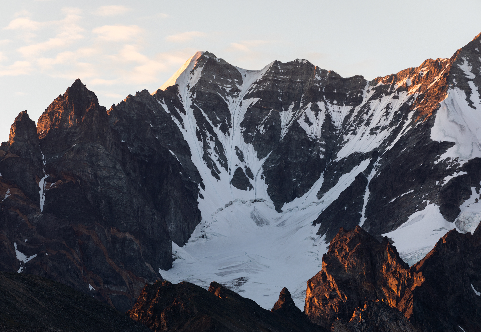
After we took a short break to enjoy the lake we continued farther up the valley until we were at the toe of the glacier. We had time to spare, so we hopped on. The glacier was completely bare of snow, and featureless, so falling into a crevasse wasn’t a concern, at least this far down. High up the glacier, at the point where it kissed the mountain, it looked far gnarlier and snowier so we stayed well away from those dangers. We ate lunch on the ice, grateful for the katabatic winds that chilled us for the first time on our trip. I got so cold I had to take out my down jacket—so it wasn’t a waste to pack it, afterall!

Our turnaround point on the glacier
Knowing that we still had another hike ahead of us we began to head back to camp. The return hike over the boulder field was agonizingly slow. Each rock, no matter how sturdy it appeared, had the potential to shift with the slightest pressure, making it a physical and mentally exhausting task. After a six hour round-trip hike we made it back to camp. By now the sun was high in the sky and had completely depleted us of our energy. We headed to the tents for a couple hours of rest before we had to shoulder our packs again.
Our 4pm alarm sounded and I reluctantly began gathering my gear and organizing my pack. At 5pm we regrouped and began our second hike of the day. On the map we saw a small lake and stream about one mile and 700 vertical feet away. This looked like a promising camp site so we headed in its direction. The climb was strenuous and the heat was still draining us of all we had. The sun was unobstructed and there was no wind to offer reprieve. By the time we made it to the top of the hill behind camp I was soaked with sweat and shaking with hunger. I quickly drank half a liter of water and ate a snickers bar. At least the worst is over, I thought as I chewed on the candy bar. From that spot all we had left was a short walk on undulating tundra and then we would be at camp.
Then came the dreaded news from Gabriel. “It’s dry. There’s no water here,” he said. I caught up to him and Andra and saw the sad scene for myself. What once had clearly been a lake was now just dried grass. This was the lowest we felt all trip. It meant that we would have to hike the rest of the way to Turquoise Lake that night in order to find a water source. We hadn’t even seen a glimpse of Turquoise Lake yet and we knew it was a little over 2,000 vertical feet below us. Just moments prior I had thought our evening hike was almost over, now I learned it had barely begun. We all stared at the empty watering hole while we let that fact sink in and gathered the resolve the push on. We decided, even though it was late, we would wait until we made camp to make dinner. That way we had something to look forward to.

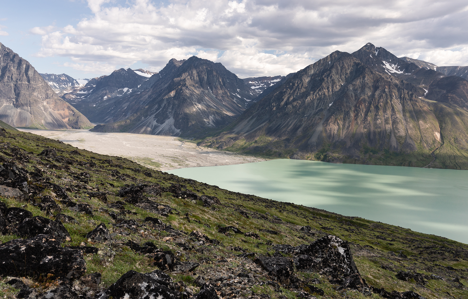
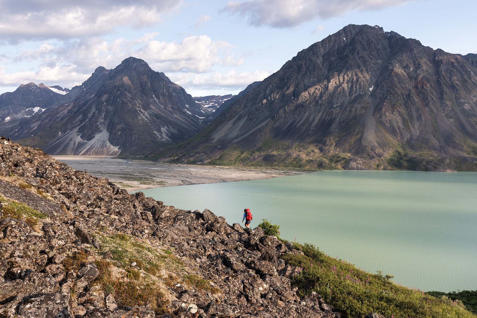
Gabriel and Andra high above Turquoise Lake
We began making our way down, and down, and down. Shortly after we left the remnants of what once a lake, Turquoise Lake came into view. It was massive and seemed so far away, the thought of having to hike to its shores in the next few hours was daunting but we continued.
As we lost elevation the lake transitioned from a bright white to a milky green and finally to its vibrant namesake shade. The scene was so captivating and inspiring that it entirely lifted our spirits. The clouds’ shadows danced over the water and threw the mountain faces in and out of a golden glow. We decided to take a long break at this spot. Alex and Gabriel time-lapsed and we all enjoyed the moment. Looking back on it, I wish that we had camped at this spot. There were nice flat spaces, and while we would have surely had to ration our water, we would not have ran out. But, at the time we all had one goal: make it to the lake. So we didn’t even consider setting up camp.
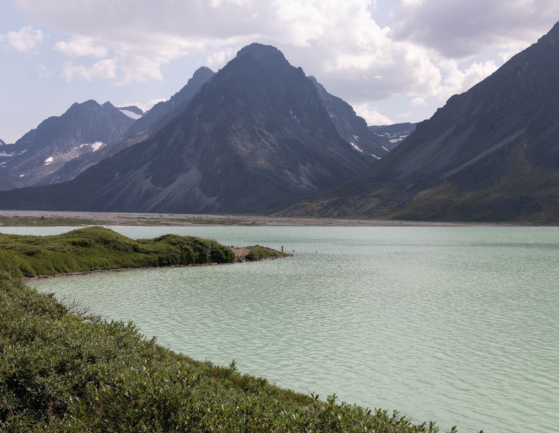
The hike down from our break spot to the lakeshore was brutal. It took only an hour, but in that hour we lost nearly 1,500’ of elevation in under a mile. We slid down loose gravel and scree, stumbled into brush, and then the crux—a final stretch through 6’ tall brush. It was so buggy that I couldn’t even open my mouth to speak or else something would fly in. I put my head down and carried on as I tried not think about the bugs I was accidentally ingesting. Eventually we broke out of the worst of the brush and found ourselves on the shore of one of the most beautiful lakes. We made our way to a sandy beach that stuck out into the lake—the only flat spot for miles horizontally and nearly 2,000 vertical feet. A few minutes from the beach, we crossed a bubbling stream which meant we would have a delicious fresh water source. The lake water was even siltier than the previous camp’s creek water so we did not want to even attempt to filter that water.
By the time we set up camp and began cooking dinner it was after 10pm, but the Alaskan sun gave us plenty of light. We even had time for a swim! The hike down had left us all hot, sweaty, and in need of a good rinse.
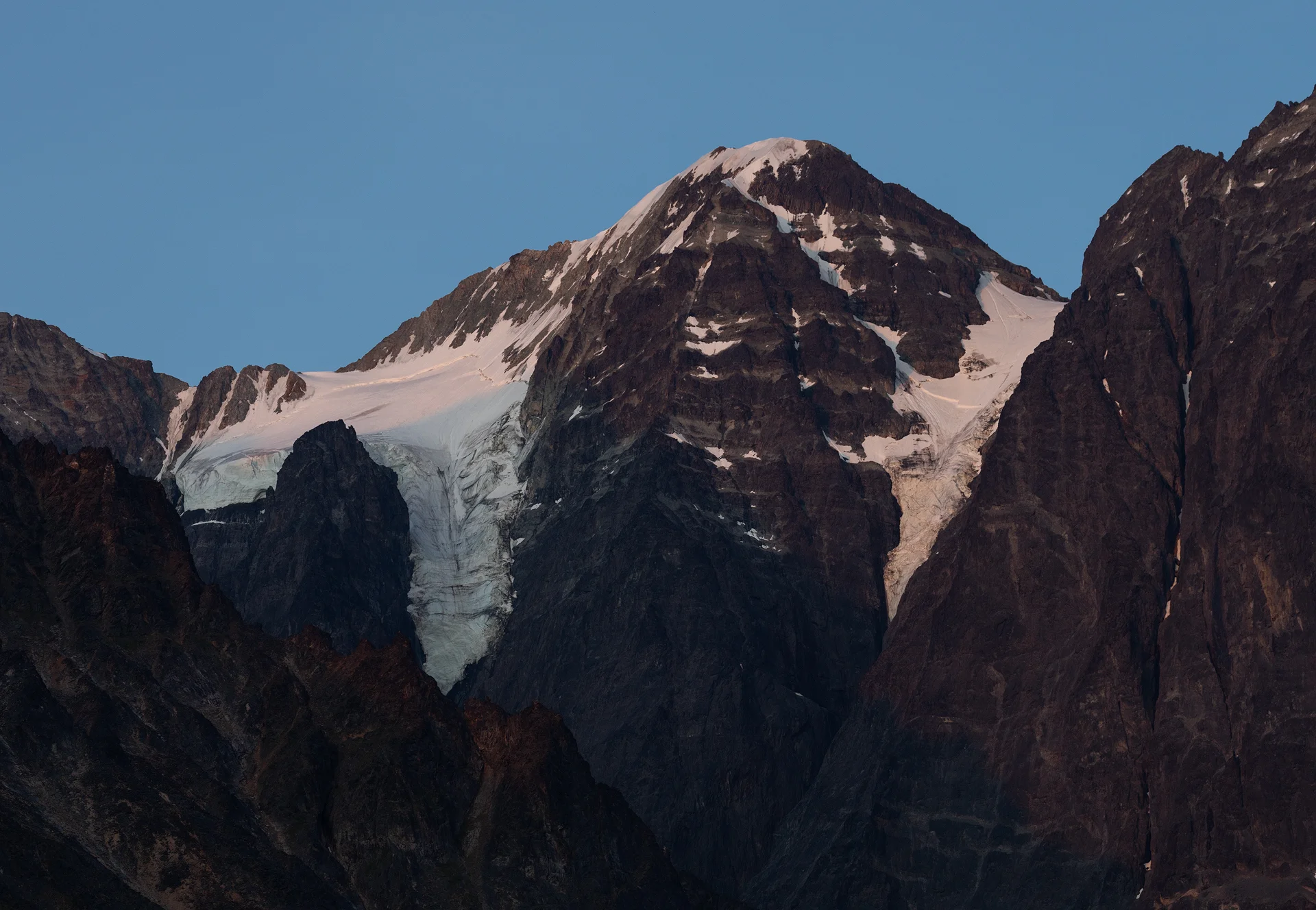
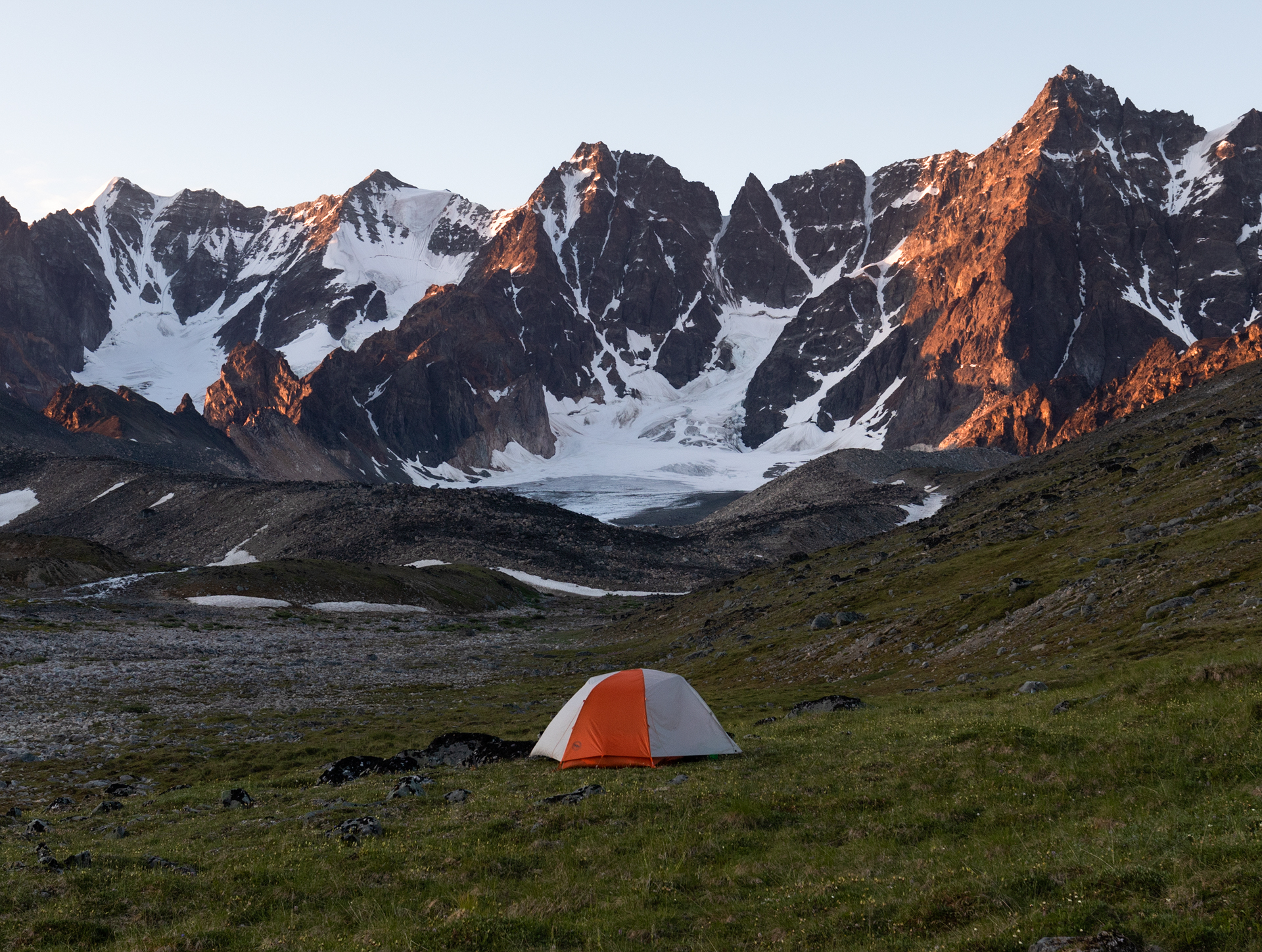
Glaciers on Telaquana Mountain at blue hour
The next morning we slept in until 9am. We had another day hike planned—this time to the head of Turquoise Valley—but wanted to give ourselves some relaxation time as well. We woke up slowly, made breakfast, and lounged around camp before leaving for the day. The heat was oppressive once again. Alex and I hung in the small shade of some overhanging foliage.
It felt like the hottest day yet. As we were starting to hike, Andra posed the question, “is it smart to hike in this heat?” We all shrugged. Probably not, but we left camp anyway, bound for the valley. The first portion of the hike comprised of bushwhacking along the lakeshore’s steep slope. It took us 20 minutes to make it a half mile to the river delta and by then we were already worked. We were hot, undoubtedly a little dehydrated, and exhausted after our previous days in the wilderness. We had two options if we wanted to continue up the valley: subject ourselves to a hot, gnarly bushwhack or walk through the bone-chilling river. We crossed one arm of the river. It was so cold it made me nauseated. The moment I got to the opposite shore I knew that was the stopping point for me. Alex and Gabriel felt similarly, but Andra wanted to explore some more. She put on her water shoes and waded through the streams, making her way up the valley. She continued on until she was barely a speck in the water. The sun seemed to goad us, coaxing us forward with inviting, clear skies, how can you not hike on a beautiful day like today? it seemed to ask, but it was just too hot to hike. Eventually Andra returned and together we headed back to camp as a group, back through the brush.
The moment we got to camp we all headed for the lake’s cool waters. Glacial-fed lakes are typically places one jumps into and then hops right back out of, but this one felt like the perfect temperature. I grabbed my inflatable air mattress and floated around. We swam for at least half an hour before finally getting out. And once we had dried off the heat began affecting us yet again. There was no escape.
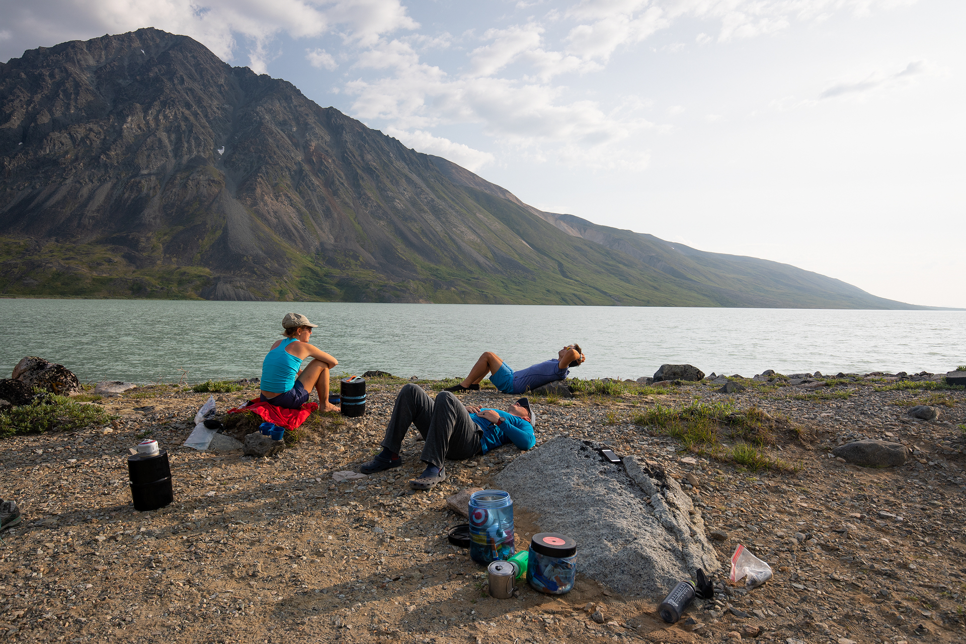
We spent the day living a reptilian life—unmoving in whatever patches of shade we could find. We napped, read, and tried to will the clouds to float between us and the sun, but they never obliged.
In the last hours of day, the sunset graced us with a cool breeze and shadows. I had planned to go to bed and sleep through the night, but at midnight Alex and I looked out the tent and saw the sky was ablaze with color and the moon was right in the middle of it. We stayed out and enjoyed the moonset until 1:30am. It felt like the perfect way to cap off the trip, and the heat of the day was already fading from memory.


Moonset during blue hour on the final night
Our final day was a short one. We held out hope for cooler temperatures, but the sun rose with a fury and blasted us with what felt like the heat of a furnace. We spent the morning swimming to stay cool again. Never have I needed to swim so much on a backpacking trip just to stay cool. It felt like we were in Southern California instead of Alaska.
Our plane was scheduled to pick us up at 3pm from the delta so we began making our way there around 1pm. Once again we had to bushwhack along the steep lakeshore and once again we made it to the delta in about 20 minutes. But, we were heading toward the opposite shore so the journey wasn’t over. There was a slight misunderstanding and we thought the plane had to pick us up where there were no rivers flowing into the lake, which was about halfway down the delta, but to get there we would have to cross many frigid streams. So we began making our way, one by one, across the streams. This was a painful and dangerous task. The rivers were noticeably rising as we slowly made our way to the pickup point. And it was all for naught, as the pilot later assured us he could have picked us up anywhere along the delta.

Alex crossing one of the many rivers of the delta
Finally, after we had crossed many streams and laid all our belongings out to dry, we heard the distant buzzing of a propeller. It was a plane and it was making its way toward the delta. The pilot dropped a group of backpackers off on the opposite shore and then began puttering over toward us.
He pulled up on the sandy beach right by our strewn-about gear pile and readied his plane. We quickly gathered our things, handed our packs to him, and crawled into the confined plane body. And just like that the trip had come to an end. Once we lifted off from the lake a wall of exhaustion hit me and I closed my eyes. The trip had been magnificent. It was hot but we had beautiful, clear days, great sunrises and sunsets, and we didn’t see a single other person. If I tried to conjure up a better trip I don’t know if I could. There are always trade-offs, always pros and cons. If it hadn’t been hot we may have been subjected to a deluge, so all in all I am grateful for the way the trip unfolded and I was left with amazing memories to look back upon for years to come.

Nearly back to Port Alsworth